Area Overview for L14 4WZ
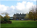
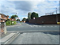
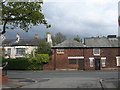
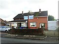
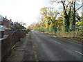
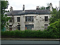
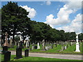
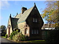
Photos of L14 4WZ


Area Information
Living in L14 4WZ offers a compact, residential experience within a small cluster of homes. With a population of 1,514, the area is defined by its proximity to essential services and transport links. The postcode covers a tight-knit community where daily life is shaped by nearby schools, retail hubs, and rail connections. Residents benefit from a balance of local amenities, including multiple primary schools and accessible railway stations. The area’s modest size means it is well-suited for those seeking a quieter lifestyle without sacrificing connectivity. While not a sprawling suburb, L14 4WZ provides a base for families and commuters, with its mix of housing and infrastructure catering to a range of needs. The presence of three primary schools within walking distance underscores its appeal to households with children. For buyers, the area’s small footprint means properties are likely to be in close proximity to each other, offering a sense of familiarity and community.
- Area Type
- Postcode
- Area Size
- Not available
- Population
- 1514
- Population Density
- 6548 people/km²
The property market in L14 4WZ is characterised by a 33% home ownership rate, with houses making up the majority of accommodation types. This indicates that while some residents own their homes, a larger proportion rent, which may reflect the area’s function as a secondary residence for commuters or its affordability. The prevalence of houses rather than flats suggests a focus on family-friendly housing, though the small population size means the market is limited in scale. Buyers should consider that the area’s compact nature means properties are closely grouped, potentially offering a sense of community but fewer choices in terms of property types. For those seeking owner-occupied homes, the market may be niche, with fewer transactions and a reliance on local demand. The lack of larger developments or new builds could mean limited scope for investment, though existing homes may retain value due to their proximity to schools and transport.
House Prices in L14 4WZ
No properties found in this postcode.
Energy Efficiency in L14 4WZ
Residents of L14 4WZ have access to a range of amenities within practical reach. Local retail options include supermarkets such as Tesco Princess, Morrisons Daily, and Lidl Fincham, ensuring everyday shopping needs are met. The area’s railway stations connect to broader networks, while nearby ferry terminals provide maritime travel options. Though specific parks or leisure facilities are not detailed, the presence of multiple schools and retail hubs suggests a focus on family-oriented amenities. The compact nature of the area means services are closely clustered, reducing travel time for daily errands. For those seeking a balance between convenience and community, L14 4WZ offers a mix of practical retail, transport links, and proximity to essential services. The character of the area is defined by its accessibility and the interplay between residential life and local infrastructure.
Amenities
Schools
Residents of L14 4WZ have access to three primary schools within practical reach: Colwell County Junior Mixed Department School, Colwell Road Infant School, and Colwell Primary School. These institutions cater to young children, providing a range of educational options for families. The presence of multiple primary schools suggests a focus on early education, which is crucial for parents seeking convenience. While no Ofsted ratings are provided, the proximity of these schools reduces the need for long commutes, supporting a family-oriented lifestyle. The mix of infant and junior schools ensures continuity in education, though the specific quality of teaching or facilities remains unquantified. For buyers prioritising schools, the area’s offerings are a key advantage, though further research would be needed to assess academic performance or school capacity.
| Rank | School | Type | Entry gender | Ages |
|---|
Explore more schools in this area
Go to Schools tabDemographics
The population of L14 4WZ is predominantly adults aged 30–64, with a median age of 47. This suggests a mature community, likely with established careers and family structures. Home ownership stands at 33%, indicating that a significant portion of residents are renters, which may reflect the area’s role as a commuter hub or its affordability compared to surrounding regions. The accommodation type is primarily houses, which aligns with the demographic profile of older, family-oriented households. The predominant ethnic group is White, with no data provided on other groups. The absence of specific figures on diversity means the community’s cultural composition remains unclear. The age profile and home ownership rate suggest a stable, low-turnover environment, where residents may have long-term ties to the area. This stability could influence local services and amenities, ensuring they cater to the needs of an older, settled population.
Household Size
Accommodation Type
Tenure
Ethnic Group
Religion
Household Composition
Age
Household Deprivation
NS-SEC
Explore more demographic insights in this area
Go to Demographics tabPlanning
Planning Constraints
- Flood RiskPremium
- Ramsar Wetland SitesPremium
- Area of Outstanding Natural BeautyPremium
- Protected Nature ReservePremium
- Protected WoodlandPremium