Area Overview for L14 4AS
Photos of L14 4AS
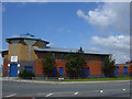
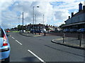
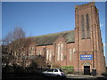
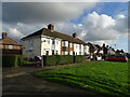
11 photos from this area
Area Information
Key information about the L14 4AS including its size, population, and administrative classification.
- Area Type
- Postcode
- Area Size
- 7386 m²
- Population
- 1299
- Population Density
- 5881 people/km²
House Prices in L14 4AS
28
Properties
£59,974
Average Sold Price
£13,000
Lowest Price
£93,000
Highest Price
Showing 28 properties
| Address | Type | Beds | Baths | Last Sale Price | Last Sale Date | |
|---|---|---|---|---|---|---|
| 17 Finch Road, Liverpool, L14 4AS | Retail | 3 | 1 | £93,000 | Mar 2022 | |
| 45 Finch Road, Liverpool, L14 4AS | Terraced | - | - | £65,814 | Feb 2020 | |
| 29 Finch Road, Liverpool, L14 4AS | Terraced | 3 | - | £68,000 | Mar 2019 | |
| 57 Finch Road, Liverpool, L14 4AS | Semi-detached | 3 | 1 | £78,000 | May 2018 | |
| 33 Finch Road, Liverpool, L14 4AS | house | 3 | 1 | £59,000 | Dec 2013 | |
| 41 Finch Road, Liverpool, L14 4AS | house | - | - | £90,000 | Dec 2006 | |
| 3 Finch Road, Liverpool, L14 4AS | Semi-detached | 3 | 1 | £55,000 | Jun 2005 | |
| 55 Finch Road, Liverpool, L14 4AS | Terraced | 3 | 1 | £17,950 | Aug 2002 | |
| 31 Finch Road, Liverpool, L14 4AS | house | - | - | £13,000 | Feb 2002 | |
| 9 Finch Road, Liverpool, L14 4AS | Terraced | - | - | - | - |
Page 1 of 3
Energy Efficiency in L14 4AS
Amenities
Schools
| Rank | School | Type | Entry gender | Ages |
|---|
Explore more schools in this area
Go to Schools tabDemographics
Household Size
Family (3-5 people)
most common
Accommodation Type
Houses
most common
Tenure
28
majority
Ethnic Group
White
most common
Religion
N/A
most common
Household Composition
N/A
most common
Age
47
median
Adults (30-64 years)
most common
Household Deprivation
N/A
with no deprivation
NS-SEC
13
in Lower managerial occupations
Explore more demographic insights in this area
Go to Demographics tabPlanning
Planning Constraints
- Flood RiskPremium
- Ramsar Wetland SitesPremium
- Area of Outstanding Natural BeautyPremium
- Protected Nature ReservePremium
- Protected WoodlandPremium