Area Overview for L13 9DS
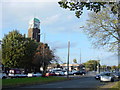
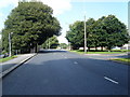
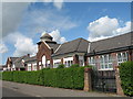
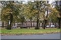
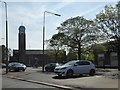
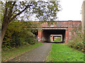
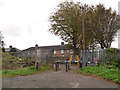
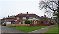
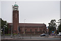
Photos of L13 9DS


Area Information
Living in L13 9DS means being part of a small, tightly knit residential cluster in England, home to 1,515 people. This area is defined by its compact nature, with homes primarily in the form of houses rather than flats or apartments. The community is predominantly composed of adults aged 30–64, reflecting a mature demographic with a median age of 47. Daily life here balances suburban tranquillity with practical connectivity. Residents benefit from proximity to rail networks, including Wavertree Technology Park and Kirkdale stations, and ferry services at Liverpool’s major terminals. The area’s digital infrastructure is robust, with a broadband score of 97, ensuring seamless online activity. While crime rates are around average, with a safety score of 58, the absence of flood risk or environmental constraints makes it a stable place to live. L13 9DS is not a sprawling suburb but a focused, self-contained community where local amenities and transport links serve the needs of its residents efficiently.
- Area Type
- Postcode
- Area Size
- Not available
- Population
- 1515
- Population Density
- 3351 people/km²
The property market in L13 9DS is shaped by its high home ownership rate of 57%, suggesting a mix of owner-occupied and rental properties. The predominance of houses over flats or apartments indicates a housing stock suited to families or individuals seeking more space. Given the small size of the area, the number of available properties is likely limited, which could make the local market competitive for buyers. Those considering the area should also look beyond its immediate boundaries, as nearby regions may offer more options. The focus on single-family homes may appeal to buyers prioritising privacy or space, though the compact nature of the postcode means proximity to amenities and transport is a key selling point. Potential buyers should also consider the balance between ownership and rental availability, as the 57% ownership rate implies a significant portion of the housing stock is occupied by renters.
House Prices in L13 9DS
No properties found in this postcode.
Energy Efficiency in L13 9DS
Life in L13 9DS is supported by a range of nearby amenities within practical reach. Retail options include Morrisons Daily Liverpool, Iceland West, and Heron Tuebrook, providing access to groceries, convenience stores, and specialist shopping. The area’s rail network includes Wavertree Technology Park, Kirkdale, and Rice Lane stations, offering links to urban centres and employment hubs. Ferry services at Liverpool Belfast Terminal and Pier Head Terminal connect residents to regional destinations, enhancing mobility for both work and leisure. While the area is small, its proximity to these services ensures residents can access shopping, transport, and travel options without long commutes. The presence of multiple rail and ferry points also suggests the area is well-integrated into broader transport networks, supporting a lifestyle that balances local convenience with regional connectivity.
Amenities
Schools
| Rank | School | Type | Entry gender | Ages |
|---|
Explore more schools in this area
Go to Schools tabDemographics
The population of L13 9DS is 1,515, with a median age of 47 and the majority of residents falling within the 30–64 age range. This suggests a community of established adults, many of whom may be in their peak working years. Home ownership is strong here, with 57% of properties owned by residents, compared to 43% rented. The accommodation type is predominantly houses, indicating a preference for single-family homes over flats or apartments. The predominant ethnic group is White, which aligns with broader demographic trends in the region. The absence of specific data on deprivation or diversity metrics means the area’s social composition remains largely unexamined in the provided data. However, the demographic profile implies a stable, long-term resident base with fewer transient populations. This stability may influence the character of local services and the pace of change in the area.
Household Size
Accommodation Type
Tenure
Ethnic Group
Religion
Household Composition
Age
Household Deprivation
NS-SEC
Explore more demographic insights in this area
Go to Demographics tabPlanning
Planning Constraints
- Flood RiskPremium
- Ramsar Wetland SitesPremium
- Area of Outstanding Natural BeautyPremium
- Protected Nature ReservePremium
- Protected WoodlandPremium