Area Overview for L13 9BN
Photos of L13 9BN
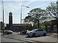
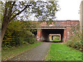
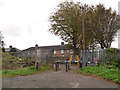

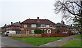
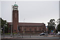
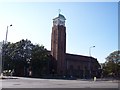
18 photos from this area
Area Information
Key information about the L13 9BN including its size, population, and administrative classification.
- Area Type
- Postcode
- Area Size
- 2.0 hectares
- Population
- 1613
- Population Density
- 5710 people/km²
House Prices in L13 9BN
48
Properties
£103,896
Average Sold Price
£28,000
Lowest Price
£170,000
Highest Price
Showing 48 properties
| Address | Type | Beds | Baths | Last Sale Price | Last Sale Date | |
|---|---|---|---|---|---|---|
| 94 Larkhill Lane, Liverpool, L13 9BN | Semi-detached | 3 | 1 | £170,000 | May 2024 | |
| 75 Larkhill Lane, Liverpool, L13 9BN | house | - | - | £152,500 | Aug 2021 | |
| 62 Larkhill Lane, Liverpool, L13 9BN | Semi-detached | 3 | 1 | £100,000 | Dec 2020 | |
| 68 Larkhill Lane, Liverpool, L13 9BN | Semi-detached | 3 | 2 | £155,000 | Jan 2020 | |
| 83 Larkhill Lane, Liverpool, L13 9BN | Semi-detached | 3 | 1 | £110,000 | Jul 2019 | |
| 54 Larkhill Lane, Liverpool, L13 9BN | Semi-detached | 3 | - | £94,000 | Dec 2015 | |
| 81 Larkhill Lane, Liverpool, L13 9BN | Semi-detached | 3 | 1 | £95,000 | Dec 2015 | |
| 71 Larkhill Lane, Liverpool, L13 9BN | Terraced | 3 | 1 | £85,000 | Nov 2014 | |
| 76 Larkhill Lane, Liverpool, L13 9BN | Terraced | 3 | - | £84,000 | Jul 2013 | |
| 88 Larkhill Lane, Liverpool, L13 9BN | Terraced | - | - | £134,000 | Aug 2005 |
Page 1 of 5
Energy Efficiency in L13 9BN
Amenities
Schools
| Rank | School | Type | Entry gender | Ages |
|---|
Explore more schools in this area
Go to Schools tabDemographics
Household Size
One person
most common
Accommodation Type
Houses
most common
Tenure
47
majority
Ethnic Group
White
most common
Religion
N/A
most common
Household Composition
N/A
most common
Age
47
median
Adults (30-64 years)
most common
Household Deprivation
N/A
with no deprivation
NS-SEC
20
in Lower managerial occupations
Explore more demographic insights in this area
Go to Demographics tabPlanning
Planning Constraints
- Flood RiskPremium
- Ramsar Wetland SitesPremium
- Area of Outstanding Natural BeautyPremium
- Protected Nature ReservePremium
- Protected WoodlandPremium