Area Overview for L13 5RS
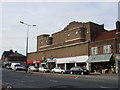
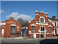
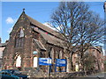
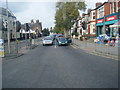
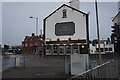
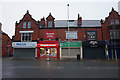
Photos of L13 5RS


Area Information
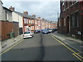
Living in L13 5RS means inhabiting a compact residential cluster in England’s north-west, where 1,448 residents share a quiet, low-density environment. This postcode is characterised by its small-scale nature, with homes predominantly in private ownership. The area’s appeal lies in its proximity to transport networks, including multiple railway stations and ferry terminals, which connect residents to Liverpool and beyond. Daily life here balances suburban tranquillity with accessibility to urban amenities. Broadband quality is near flawless, scoring 99 out of 100, ensuring seamless digital connectivity for remote work or entertainment. The community is largely composed of adults aged 30–64, suggesting a mature demographic with established routines. While the area lacks large-scale commercial hubs, its practical reach includes retail outlets like Iceland and Aldi, offering convenience for everyday needs. For those prioritising safety, the low flood risk and absence of protected natural sites are reassuring. However, the high crime risk score of 25 means residents should consider enhanced security measures. L13 5RS is a niche postcode, ideal for those seeking a manageable, connected yet low-key living environment.
- Area Type
- Postcode
- Area Size
- Not available
- Population
- 1448
- Population Density
- 10126 people/km²
The property market in L13 5RS is defined by its small scale and focus on houses, which make up the majority of accommodation types. With only 37% of homes owner-occupied, the area leans more towards rental properties than private ownership. This dynamic may limit availability for buyers, as the housing stock is limited and competition could be fierce. The presence of houses rather than flats or apartments suggests a preference for traditional, possibly larger properties, which may appeal to families or those seeking space. However, the low population and small postcode size mean the market is not expansive. Buyers should consider the area’s limited growth potential and the need for security measures due to the high crime risk. For those prioritising a quiet, low-density environment with access to transport, L13 5RS offers a niche opportunity, though it is not a typical hotspot for property investment.
House Prices in L13 5RS
No properties found in this postcode.
Energy Efficiency in L13 5RS
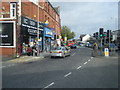
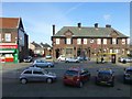
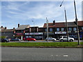
Residents of L13 5RS have access to a range of amenities within practical reach, including retail outlets such as Iceland, Heron Old, Aldi, and Old, which cater to everyday shopping needs. The area’s rail network provides connections to key hubs like Broad Green and Edge Hill, facilitating commuting to work or leisure. For travel beyond the region, nearby ferry terminals offer links to Liverpool’s ports and the Isle of Man. The presence of two listings for Liverpool John Lennon Airport highlights the area’s proximity to air travel. While the data does not detail parks or leisure facilities, the absence of protected natural sites suggests a focus on urban convenience rather than green spaces. The mix of retail, transport, and travel options creates a lifestyle that balances practicality with connectivity, ideal for those prioritising accessibility over expansive recreational areas.
Amenities
Schools
The nearest school to L13 5RS is Broadgreen Primary, a primary school with an Ofsted rating of ‘good’. This single school serves the area’s educational needs for younger children, though families requiring secondary education may need to look beyond the immediate vicinity. The absence of secondary schools or specialist institutions in the data means parents should plan for commuting to nearby towns. Broadgreen Primary’s ‘good’ rating suggests a reliable foundation for early education, but the lack of a broader school network could be a limitation. For families prioritising a strong local school system, L13 5RS may require additional research into nearby options. The school’s presence, however, is a positive factor for those valuing accessible primary education without long commutes.
| Rank | School | Type | Entry gender | Ages |
|---|
Explore more schools in this area
Go to Schools tabDemographics
The population of L13 5RS is 1,448, with a median age of 47, indicating a mature community dominated by adults aged 30–64. Home ownership here is relatively low at 37%, suggesting a mix of renters and owner-occupiers. The area’s accommodation is primarily houses, which is uncommon in many urban zones, reflecting a suburban or semi-rural character. The predominant ethnic group is White, with no specific data on other demographics. This age profile implies a stable, long-term resident base, though the younger population is limited. The 37% home ownership rate may indicate a reliance on rental properties, which could affect housing market dynamics. For buyers, this suggests a niche market with limited stock, potentially increasing competition. The absence of detailed diversity data means the community’s social composition remains largely unexplored in public records. Overall, the area caters to those seeking a quiet, established living environment with minimal turnover.
Household Size
Accommodation Type
Tenure
Ethnic Group
Religion
Household Composition
Age
Household Deprivation
NS-SEC
Explore more demographic insights in this area
Go to Demographics tabPlanning
Planning Constraints
- Flood RiskPremium
- Ramsar Wetland SitesPremium
- Area of Outstanding Natural BeautyPremium
- Protected Nature ReservePremium
- Protected WoodlandPremium