Area Overview for L13 2HG
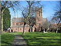
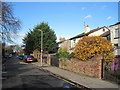
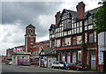
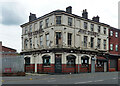
Photos of L13 2HG


Area Information
Living in L13 2HG means being part of a small, tightly knit residential cluster in England, home to 1,298 people. This area is defined by its proximity to key transport links and a mix of local amenities. The community is predominantly composed of adults aged 30–64, with a median age of 47, suggesting a stable population of professionals and families. While the area is compact, it offers practical access to nearby retail, rail, and ferry services. The broadband score of 100 ensures seamless digital connectivity, supporting remote work and daily internet use. However, the high crime risk, rated critical, demands awareness of local safety measures. Despite this, the absence of environmental constraints like flood zones or protected landscapes means residents face fewer planning restrictions. L13 2HG is a pragmatic choice for those prioritising connectivity and convenience, though its small size means the housing market is limited to a mix of owner-occupied and rental properties.
- Area Type
- Postcode
- Area Size
- Not available
- Population
- 1298
- Population Density
- 6369 people/km²
The property market in L13 2HG is characterised by a 44% home ownership rate, indicating that nearly half of properties are owner-occupied, while the remainder are likely rented. The area is predominantly composed of houses, which suggests a lack of high-density housing such as flats or apartments. This mix of ownership and rental properties may appeal to both long-term residents and those seeking short-term accommodation. The small size of the area means the housing stock is limited, potentially creating competition for available properties. Buyers should consider the proximity to transport links, including rail and ferry services, which could enhance the area’s appeal. However, the absence of specific data on property prices or availability means the market remains opaque. The focus on houses may also mean fewer options for first-time buyers or those seeking smaller homes.
House Prices in L13 2HG
No properties found in this postcode.
Energy Efficiency in L13 2HG
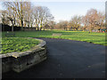
The lifestyle in L13 2HG is shaped by its proximity to retail, transport, and travel hubs. Nearby shops include Tesco Liverpool, Asda Stoneycroft, and Farmfoods Old, offering everyday essentials within walking or short driving distance. The area’s rail stations connect residents to broader networks, while ferry terminals provide access to the Isle of Man, Dublin, and Birkenhead. The presence of Liverpool John Lennon Airport adds convenience for air travel. However, the data does not mention parks, leisure facilities, or dining options, suggesting the area’s character is defined by practicality rather than cultural or recreational amenities. The mix of retail and transport links makes daily life efficient, though residents may need to travel further for entertainment or leisure activities. The compact nature of the area means convenience is prioritised over expansive public spaces.
Amenities
Schools
The nearest school to L13 2HG is Selkirk Independent School, a special school catering to students with specific educational needs. No other schools are listed in the data, meaning the area’s educational options are limited to this single institution. Families requiring mainstream schooling may need to look further afield, as no primary or secondary schools are mentioned. The presence of a special school suggests the area may attract residents with children who require tailored educational support. However, the lack of additional schools raises questions about the suitability of L13 2HG for families seeking a broader range of educational facilities. Prospective buyers should investigate nearby schools beyond the immediate postcode to ensure their children’s needs are met.
| Rank | School | Type | Entry gender | Ages |
|---|
Explore more schools in this area
Go to Schools tabDemographics
The population of L13 2HG is 1,298, with a median age of 47. The majority of residents fall within the 30–64 age range, indicating a community of established professionals and families. Home ownership stands at 44%, suggesting a balance between owner-occupied and rental properties. The area is predominantly composed of houses, with no data on flats or other accommodation types. The predominant ethnic group is White, though no further diversity metrics are provided. The age profile implies a stable, low-turnover population, with fewer young families or elderly residents. This demographic structure shapes a community focused on long-term living, with fewer transient residents. The lack of specific deprivation data means quality of life assessments remain unquantified, but the age range and ownership figures suggest a mature, settled environment.
Household Size
Accommodation Type
Tenure
Ethnic Group
Religion
Household Composition
Age
Household Deprivation
NS-SEC
Explore more demographic insights in this area
Go to Demographics tabPlanning
Planning Constraints
- Flood RiskPremium
- Ramsar Wetland SitesPremium
- Area of Outstanding Natural BeautyPremium
- Protected Nature ReservePremium
- Protected WoodlandPremium