Area Overview for L13 1EX
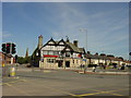
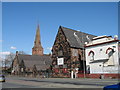
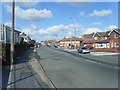
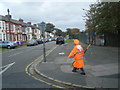
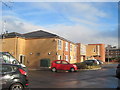
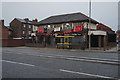
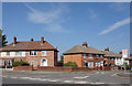
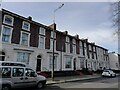
Photos of L13 1EX


Area Information
Living in L13 1EX offers a compact, residential lifestyle nestled within Liverpool’s broader urban fabric. With a population of 1,413, this postcode area is a small cluster of homes, ideal for those seeking a quiet, community-oriented environment. The area’s proximity to major transport hubs, including multiple railway stations and ferry terminals, ensures easy access to Liverpool’s cultural and economic centres. Residents benefit from excellent digital connectivity, with a broadband score of 100 and a mobile coverage score of 85, making remote work and daily internet use seamless. While the area is not large, its strategic location near key amenities and transport links means it balances suburban tranquillity with urban convenience. The demographic profile suggests a mature population, with a median age of 47 and a strong presence of adults aged 30–64. This hints at a stable, established community, though the relatively low home ownership rate of 40% indicates a mix of rental properties and owner-occupied homes. For those prioritising safety, the area has no flood risk or protected natural sites, though crime rates are above average.
- Area Type
- Postcode
- Area Size
- Not available
- Population
- 1413
- Population Density
- 5086 people/km²
The property market in L13 1EX is characterised by a 40% home ownership rate, meaning most homes are rented rather than owner-occupied. This suggests a rental market dominated by private landlords or housing associations, with fewer opportunities for buyers seeking long-term investment. The accommodation type is primarily houses, which is uncommon in densely populated urban areas, indicating a more spacious, low-density development. The small size of the postcode area means the housing stock is limited, and buyers may find competition for properties. For those considering the area, the predominance of houses could appeal to families or individuals seeking more private living space. However, the low home ownership rate and compact size mean the market is not ideal for those prioritising property ownership or seeking a wide range of housing options.
House Prices in L13 1EX
No properties found in this postcode.
Energy Efficiency in L13 1EX
Lifestyle in L13 1EX is shaped by its proximity to retail, transport, and leisure hubs. The area is within practical reach of five retail outlets, including Tesco Liverpool, Aldi Old, and M&S Liverpool, offering everyday shopping needs. Residents can access multiple railway stations, ferry terminals, and an airport, ensuring easy travel to cultural and commercial centres. The presence of Liverpool John Lennon Airport provides direct flight connections, while ferry services link to nearby destinations. The area’s compact size means amenities are concentrated, though the lack of detailed data on parks or leisure facilities leaves some aspects of daily life unexplored. For those prioritising convenience, the mix of retail, transport, and travel options makes L13 1EX a functional base for urban living.
Amenities
Schools
The nearest school to L13 1EX is St Mary’s CofE Primary School, a primary education institution serving the local community. No secondary schools are listed in the data, meaning families with older children may need to look beyond the immediate area for secondary education. The presence of a primary school suggests the area is suitable for young families, though the lack of secondary schooling could be a consideration for those requiring a full range of educational options. The school type indicates a faith-based education model, which may align with the preferences of some residents. Without additional data on Ofsted ratings or pupil outcomes, it is unclear how the school performs academically, but its existence provides a local resource for primary-age children.
| Rank | School | Type | Entry gender | Ages |
|---|
Explore more schools in this area
Go to Schools tabDemographics
The population of L13 1EX is 1,413, with a median age of 47. The majority of residents fall within the 30–64 age range, suggesting a community of working-age adults and older individuals. Home ownership is relatively low at 40%, implying that a significant portion of the housing stock is rented. The predominant accommodation type is houses, which is unusual for urban areas, indicating a more spread-out, suburban character. The predominant ethnic group is White, with no data provided on other demographics. The age profile and home ownership figures suggest a stable but not rapidly growing population, likely composed of long-term residents. The absence of specific deprivation data means the area’s socioeconomic profile remains unclear, but the age distribution points to a community with established careers and family structures.
Household Size
Accommodation Type
Tenure
Ethnic Group
Religion
Household Composition
Age
Household Deprivation
NS-SEC
Explore more demographic insights in this area
Go to Demographics tabPlanning
Planning Constraints
- Flood RiskPremium
- Ramsar Wetland SitesPremium
- Area of Outstanding Natural BeautyPremium
- Protected Nature ReservePremium
- Protected WoodlandPremium