Area Overview for L12 7JN
Photos of L12 7JN
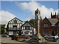
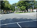
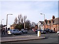
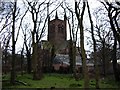

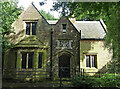
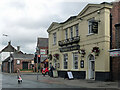
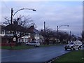
28 photos from this area
Area Information
Key information about the L12 7JN including its size, population, and administrative classification.
- Area Type
- Postcode
- Area Size
- 1.3 hectares
- Population
- 1486
- Population Density
- 3973 people/km²
House Prices in L12 7JN
61
Properties
£134,295
Average Sold Price
£43,000
Lowest Price
£270,000
Highest Price
Showing 61 properties
| Address | Type | Beds | Baths | Last Sale Price | Last Sale Date | |
|---|---|---|---|---|---|---|
| 81 Eaton Road North, Liverpool, L12 7JN | Terraced | 2 | 1 | £185,000 | Sep 2025 | |
| 87 Eaton Road North, Liverpool, L12 7JN | Terraced | 3 | 1 | £215,000 | Jun 2025 | |
| 43 Eaton Road North, Liverpool, L12 7JN | Terraced | 2 | 1 | £167,000 | Jan 2025 | |
| 115 Eaton Road North, Liverpool, L12 7JN | Semi-detached | 3 | 1 | £195,000 | Jul 2024 | |
| 51 Eaton Road North, Liverpool, L12 7JN | Terraced | 2 | 1 | £165,000 | Apr 2024 | |
| 79 Eaton Road North, Liverpool, L12 7JN | Terraced | 2 | 2 | £190,000 | Nov 2023 | |
| 61 Eaton Road North, Liverpool, L12 7JN | Terraced | 2 | 1 | £155,000 | Jul 2023 | |
| 117 Eaton Road North, Liverpool, L12 7JN | house | 3 | - | £226,000 | Jun 2023 | |
| 39 Eaton Road North, Liverpool, L12 7JN | Terraced | 2 | 1 | £140,000 | Oct 2022 | |
| 25 Eaton Road North, Liverpool, L12 7JN | house | 2 | - | £160,000 | Sep 2022 |
Page 1 of 7
Energy Efficiency in L12 7JN
Amenities
Schools
| Rank | School | Type | Entry gender | Ages |
|---|
Explore more schools in this area
Go to Schools tabDemographics
Household Size
One person
most common
Accommodation Type
Houses
most common
Tenure
71
majority
Ethnic Group
White
most common
Religion
N/A
most common
Household Composition
N/A
most common
Age
47
median
Adults (30-64 years)
most common
Household Deprivation
N/A
with no deprivation
NS-SEC
33
in Lower managerial occupations
Explore more demographic insights in this area
Go to Demographics tabPlanning
Planning Constraints
- Flood RiskPremium
- Ramsar Wetland SitesPremium
- Area of Outstanding Natural BeautyPremium
- Protected Nature ReservePremium
- Protected WoodlandPremium