Area Overview for L12 7HH
Photos of L12 7HH
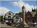
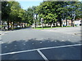
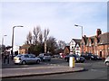
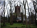
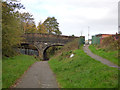
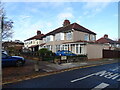

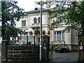
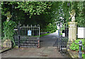
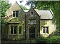
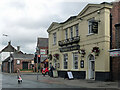
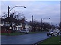
28 photos from this area
Area Information
Key information about the L12 7HH including its size, population, and administrative classification.
- Area Type
- Postcode
- Area Size
- 8484 m²
- Population
- 1608
- Population Density
- 5654 people/km²
House Prices in L12 7HH
26
Properties
£123,688
Average Sold Price
£33,800
Lowest Price
£195,000
Highest Price
Showing 26 properties
| Address | Type | Beds | Baths | Last Sale Price | Last Sale Date | |
|---|---|---|---|---|---|---|
| 60 Tollerton Road, Liverpool, L12 7HH | Terraced | 3 | 1 | £195,000 | Jul 2023 | |
| 98 Tollerton Road, Liverpool, L12 7HH | Retail | 3 | 1 | £180,000 | Sep 2022 | |
| 62 Tollerton Road, Liverpool, L12 7HH | Terraced | 3 | 1 | £190,000 | Mar 2022 | |
| 88 Tollerton Road, Liverpool, L12 7HH | house | - | - | £115,000 | Nov 2021 | |
| 76 Tollerton Road, Liverpool, L12 7HH | Terraced | 3 | 1 | £157,000 | Sep 2020 | |
| 72 Tollerton Road, Liverpool, L12 7HH | Semi-detached | 3 | 1 | £126,000 | Mar 2017 | |
| 54 Tollerton Road, Liverpool, L12 7HH | Terraced | 3 | - | £125,000 | Feb 2017 | |
| 92 Tollerton Road, Liverpool, L12 7HH | house | 3 | 1 | £120,000 | Oct 2009 | |
| 58 Tollerton Road, Liverpool, L12 7HH | Semi-detached | - | - | £112,000 | Jan 2008 | |
| 52 Tollerton Road, Liverpool, L12 7HH | Terraced | - | - | £63,500 | Apr 2003 |
Page 1 of 3
Energy Efficiency in L12 7HH
Amenities
Schools
| Rank | School | Type | Entry gender | Ages |
|---|
Explore more schools in this area
Go to Schools tabDemographics
Household Size
Family (3-5 people)
most common
Accommodation Type
Houses
most common
Tenure
64
majority
Ethnic Group
White
most common
Religion
N/A
most common
Household Composition
N/A
most common
Age
47
median
Adults (30-64 years)
most common
Household Deprivation
N/A
with no deprivation
NS-SEC
22
in Lower managerial occupations
Explore more demographic insights in this area
Go to Demographics tabPlanning
Planning Constraints
- Flood RiskPremium
- Ramsar Wetland SitesPremium
- Area of Outstanding Natural BeautyPremium
- Protected Nature ReservePremium
- Protected WoodlandPremium