Area Overview for L12 4YE
Photos of L12 4YE
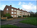
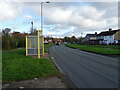

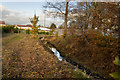
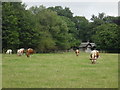

12 photos from this area
Area Information
Key information about the L12 4YE including its size, population, and administrative classification.
- Area Type
- Postcode
- Area Size
- 1.5 hectares
- Population
- 1370
- Population Density
- 1226 people/km²
House Prices in L12 4YE
37
Properties
£88,983
Average Sold Price
£21,000
Lowest Price
£230,000
Highest Price
Showing 37 properties
| Address | Type | Beds | Baths | Last Sale Price | Last Sale Date | |
|---|---|---|---|---|---|---|
| 179 Deysbrook Lane, Liverpool, L12 4YE | Semi-detached | 3 | 1 | £205,000 | Sep 2023 | |
| 181 Deysbrook Lane, Liverpool, L12 4YE | house | 3 | 2 | £230,000 | Oct 2022 | |
| 191 Deysbrook Lane, Liverpool, L12 4YE | Semi-detached | 3 | 1 | £100,000 | Sep 2019 | |
| 149 Deysbrook Lane, Liverpool, L12 4YE | Semi-detached | 2 | 1 | £82,000 | Aug 2019 | |
| 145 Deysbrook Lane, Liverpool, L12 4YE | Semi-detached | 2 | 1 | £71,000 | Aug 2019 | |
| 161 Deysbrook Lane, Liverpool, L12 4YE | Terraced | 3 | - | £102,500 | Nov 2014 | |
| 173 Deysbrook Lane, Liverpool, L12 4YE | Semi-detached | - | - | £79,500 | Mar 2012 | |
| 163 Deysbrook Lane, Liverpool, L12 4YE | Terraced | - | - | £85,000 | Feb 2010 | |
| 175 Deysbrook Lane, Liverpool, L12 4YE | house | 3 | - | £92,000 | Nov 2009 | |
| 165 Deysbrook Lane, Liverpool, L12 4YE | Terraced | 2 | - | £95,000 | Dec 2007 |
Page 1 of 4
Energy Efficiency in L12 4YE
Amenities
Schools
| Rank | School | Type | Entry gender | Ages |
|---|
Explore more schools in this area
Go to Schools tabDemographics
Household Size
Family (3-5 people)
most common
Accommodation Type
Houses
most common
Tenure
74
majority
Ethnic Group
White
most common
Religion
N/A
most common
Household Composition
N/A
most common
Age
47
median
Adults (30-64 years)
most common
Household Deprivation
N/A
with no deprivation
NS-SEC
33
in Lower managerial occupations
Explore more demographic insights in this area
Go to Demographics tabPlanning
Planning Constraints
- Flood RiskPremium
- Ramsar Wetland SitesPremium
- Area of Outstanding Natural BeautyPremium
- Protected Nature ReservePremium
- Protected WoodlandPremium