Area Overview for L12 0RW
Photos of L12 0RW
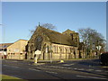
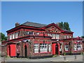
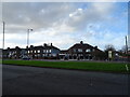
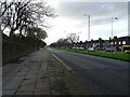
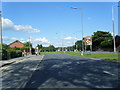
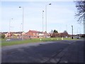
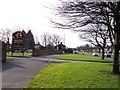
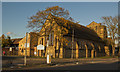
9 photos from this area
Area Information
Key information about the L12 0RW including its size, population, and administrative classification.
- Area Type
- Postcode
- Area Size
- 2.0 hectares
- Population
- 1457
- Population Density
- 6478 people/km²
House Prices in L12 0RW
52
Properties
£85,522
Average Sold Price
£34,450
Lowest Price
£215,000
Highest Price
Showing 52 properties
| Address | Type | Beds | Baths | Last Sale Price | Last Sale Date | |
|---|---|---|---|---|---|---|
| 2 Hollocombe Road, Liverpool, L12 0RW | Detached | 3 | 3 | £215,000 | Oct 2023 | |
| 36 Hollocombe Road, Liverpool, L12 0RW | Detached | 3 | 2 | £126,000 | Aug 2016 | |
| 6 Hollocombe Road, Liverpool, L12 0RW | Detached | 3 | 1 | £148,000 | Dec 2015 | |
| 55 Hollocombe Road, Liverpool, L12 0RW | Detached | 3 | 3 | £137,250 | Dec 2014 | |
| 22 Hollocombe Road, Liverpool, L12 0RW | Semi-detached | 3 | 1 | £118,500 | Oct 2014 | |
| 26A Hollocombe Road, Liverpool, L12 0RW | house | 3 | - | £138,000 | Aug 2013 | |
| 26 Hollocombe Road, Liverpool, L12 0RW | Detached | 4 | 1 | £147,500 | Feb 2013 | |
| 32 Hollocombe Road, Liverpool, L12 0RW | house | - | - | £117,000 | Jul 2010 | |
| 5 Hollocombe Road, Liverpool, L12 0RW | house | - | - | £148,000 | Jul 2010 | |
| 17 Hollocombe Road, Liverpool, L12 0RW | Semi-detached | - | - | £159,995 | Dec 2007 |
Page 1 of 6
Energy Efficiency in L12 0RW
Amenities
Schools
| Rank | School | Type | Entry gender | Ages |
|---|
Explore more schools in this area
Go to Schools tabDemographics
Household Size
Family (3-5 people)
most common
Accommodation Type
Houses
most common
Tenure
75
majority
Ethnic Group
White
most common
Religion
N/A
most common
Household Composition
N/A
most common
Age
47
median
Adults (30-64 years)
most common
Household Deprivation
N/A
with no deprivation
NS-SEC
27
in Lower managerial occupations
Explore more demographic insights in this area
Go to Demographics tabPlanning
Planning Constraints
- Flood RiskPremium
- Ramsar Wetland SitesPremium
- Area of Outstanding Natural BeautyPremium
- Protected Nature ReservePremium
- Protected WoodlandPremium