Area Overview for L12 0QN
Photos of L12 0QN
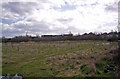
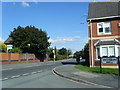
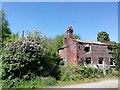
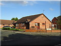
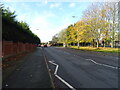
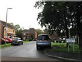
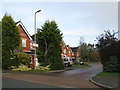
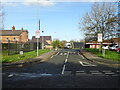
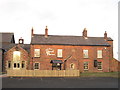
11 photos from this area
Area Information
Key information about the L12 0QN including its size, population, and administrative classification.
- Area Type
- Postcode
- Area Size
- 2.8 hectares
- Population
- 1366
- Population Density
- 5820 people/km²
House Prices in L12 0QN
56
Properties
£150,862
Average Sold Price
£2,698
Lowest Price
£360,000
Highest Price
Showing 56 properties
| Address | Type | Beds | Baths | Last Sale Price | Last Sale Date | |
|---|---|---|---|---|---|---|
| 54 Nightingale Road, Liverpool, L12 0QN | Detached | 4 | 2 | £360,000 | Dec 2024 | |
| 58 Nightingale Road, Liverpool, L12 0QN | house | - | - | £360,000 | Dec 2022 | |
| 41 Nightingale Road, Liverpool, L12 0QN | Detached | 4 | - | £360,000 | Oct 2022 | |
| 89 Nightingale Road, Liverpool, L12 0QN | Detached | 4 | 2 | £298,000 | Jan 2022 | |
| 57 Nightingale Road, Liverpool, L12 0QN | house | - | - | £235,000 | Dec 2020 | |
| 81 Nightingale Road, Liverpool, L12 0QN | Detached | 4 | 2 | £245,500 | Jul 2019 | |
| 99 Nightingale Road, Liverpool, L12 0QN | house | 4 | 3 | £230,000 | Jun 2018 | |
| 68 Nightingale Road, Liverpool, L12 0QN | Detached | 4 | 1 | £220,000 | Apr 2018 | |
| 85 Nightingale Road, Liverpool, L12 0QN | Detached | 4 | 2 | £207,500 | Feb 2018 | |
| 88 Nightingale Road, Liverpool, L12 0QN | Detached | 4 | - | £213,000 | Jul 2017 |
Page 1 of 6
Energy Efficiency in L12 0QN
Amenities
Schools
| Rank | School | Type | Entry gender | Ages |
|---|
Explore more schools in this area
Go to Schools tabDemographics
Household Size
Family (3-5 people)
most common
Accommodation Type
Houses
most common
Tenure
89
majority
Ethnic Group
White
most common
Religion
N/A
most common
Household Composition
N/A
most common
Age
47
median
Adults (30-64 years)
most common
Household Deprivation
N/A
with no deprivation
NS-SEC
35
in Lower managerial occupations
Explore more demographic insights in this area
Go to Demographics tabPlanning
Planning Constraints
- Flood RiskPremium
- Ramsar Wetland SitesPremium
- Area of Outstanding Natural BeautyPremium
- Protected Nature ReservePremium
- Protected WoodlandPremium