Area Overview for L11 9YJ
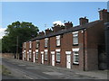
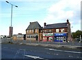
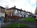
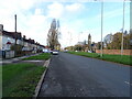
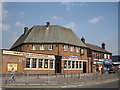
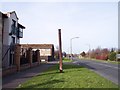
Photos of L11 9YJ


Area Information
L11 9YJ is a compact residential postcode area in England, spanning just 2.2 hectares and home to 1903 residents. Its high population density of 87,429 people per square kilometre reflects a tightly knit community, where proximity to services and transport is a defining feature. The area is characterised by a mature demographic, with a median age of 47 and a majority of residents aged between 30 and 64. This suggests a stable population, likely composed of families and long-term residents. The area’s small size means it is a microcosm of suburban living, with homes predominating over flats or apartments. While the data does not specify the exact nature of the housing stock, the high proportion of owner-occupiers (32%) indicates a mix of private and rental properties. Living here offers convenience, with amenities and transport hubs within easy reach, though the limited space means the area is best suited for those prioritising accessibility over expansive living spaces.
- Area Type
- Postcode
- Area Size
- 2.2 hectares
- Population
- 1903
- Population Density
- 2133 people/km²
The property market in L11 9YJ is shaped by its small size and high population density. With 32% of residents owning their homes, the area is not heavily dominated by owner-occupation, suggesting a significant proportion of rental properties. The accommodation type is primarily houses, which may appeal to families or individuals seeking more space than flats. However, the limited area size means the housing stock is constrained, and buyers may need to consider nearby areas for more options. The mix of owner-occupied and rental properties indicates a balance between long-term residents and transient tenants. For buyers, this suggests a market where properties are likely to be in demand, though competition for available homes may be fierce due to the area’s compact nature.
House Prices in L11 9YJ
No properties found in this postcode.
Energy Efficiency in L11 9YJ
The lifestyle in L11 9YJ is supported by a range of nearby amenities. Within practical reach are five retail venues, including Spar, Iceland Stonedale, and Farmfoods Croxteth, offering everyday shopping and food needs. The proximity to railway stations and ferry terminals ensures easy access to broader transport networks, facilitating both local and long-distance travel. While the data does not specify parks or leisure facilities, the combination of retail, transport, and proximity to urban hubs suggests a convenient, practical lifestyle. Residents can enjoy a mix of local services and the ability to access larger cities for additional amenities, making the area suitable for those prioritising accessibility and connectivity.
Amenities
Schools
Residents of L11 9YJ have access to two primary schools: Croxteth Community Comprehensive School and Stonebridge Lane County Primary School. Both institutions serve the local community, providing education for younger children. The presence of two primary schools suggests a focus on early education, though the data does not include Ofsted ratings or specific academic performance metrics. For families, this ensures proximity to schooling, reducing the need for long commutes. However, the absence of secondary schools in the immediate area may require students to travel to nearby towns for further education. The mix of primary schools supports a range of educational needs, though prospective homebuyers should investigate additional school options beyond the immediate vicinity.
| Rank | School | Type | Entry gender | Ages |
|---|
Explore more schools in this area
Go to Schools tabDemographics
The population of L11 9YJ is predominantly composed of adults aged 30 to 64, with a median age of 47. This suggests a community of established professionals, families, and retirees. The 32% home ownership rate indicates that a significant portion of residents rent, which may influence the local rental market and community dynamics. The area is largely composed of houses, which aligns with the presence of a mature demographic seeking more space than flats. The predominant ethnic group is White, reflecting the broader demographic trends in the region. The data does not provide specific information on deprivation or diversity beyond this, but the high population density and age profile suggest a community focused on stability and long-term residency.
Household Size
Accommodation Type
Tenure
Ethnic Group
Religion
Household Composition
Age
Household Deprivation
NS-SEC
Explore more demographic insights in this area
Go to Demographics tabPlanning
Planning Constraints
- Flood RiskPremium
- Ramsar Wetland SitesPremium
- Area of Outstanding Natural BeautyPremium
- Protected Nature ReservePremium
- Protected WoodlandPremium