Area Overview for L11 2XZ
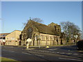
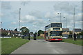
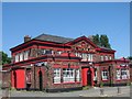
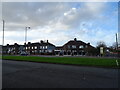
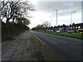
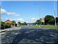
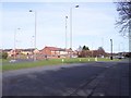
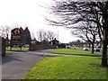
Photos of L11 2XZ
Area Information
Living in L11 2XZ means inhabiting a tightly packed residential cluster in England, where 1,712 people reside across 7,547 square metres. This compact area, with a population density of 226,849 people per square kilometre, reflects a densely populated yet small-scale community. The median age of 47 suggests a mature demographic, with the majority of residents falling within the 30–64 age range. This indicates a mix of middle-aged professionals and families, likely drawn to the area for its proximity to transport links and local amenities. While the postcode covers a limited physical space, its strategic location offers access to nearby rail and ferry services, connecting residents to Liverpool and beyond. The area’s character is defined by its residential focus, with homes predominating over flats, and a predominantly White population. Daily life here is shaped by proximity to retail, transport, and the surrounding urban infrastructure, making it a practical choice for those prioritising convenience over expansive living spaces.
- Area Type
- Postcode
- Area Size
- 7547 m²
- Population
- 1712
- Population Density
- 7919 people/km²
The property market in L11 2XZ is characterised by a low home ownership rate of 22%, meaning most residents are renters rather than homeowners. The accommodation type is predominantly houses, which is unusual for a high-density area. This suggests a limited housing stock focused on single-family homes, possibly inherited or long-term rental properties. The small size of the postcode means the area itself offers few properties, with buyers likely needing to look beyond immediate surroundings for options. For those seeking owner-occupied homes, the market may be constrained by the area’s scale and the dominance of rental properties. The focus on houses rather than flats may appeal to those prioritising space, though the high population density implies proximity to neighbours. Prospective buyers should consider the limited availability and the need to balance proximity to amenities with housing choice.
House Prices in L11 2XZ
Showing 2 properties
| Address | Type | Beds | Baths | Last Sale Price | Last Sale Date | |
|---|---|---|---|---|---|---|
| Norris Green Womens Health Group, Carr Lane, Liverpool, L11 2XZ | commercial | - | - | - | - | |
| Norris Green Community Health Forum, Carr Lane, Liverpool, L11 2XZ | commercial | - | - | - | - |
Energy Efficiency in L11 2XZ
Lifestyle in L11 2XZ is shaped by its proximity to retail, transport, and waterfront amenities. Nearby shops include Aldi Norris, Farmfoods Croxteth, and Iceland Norris, offering everyday essentials within walking distance. The area’s rail stations and ferry terminals connect residents to broader networks, facilitating access to urban centres like Liverpool or coastal routes. While the data does not mention parks or leisure facilities, the presence of multiple retail and transport options suggests a focus on practicality over expansive recreational spaces. The compact nature of the postcode means amenities are tightly clustered, making daily errands and travel efficient. Residents can enjoy a mix of local shopping and transport links, though larger leisure opportunities may require venturing beyond the immediate area.
Amenities
Schools
The only school listed near L11 2XZ is Ellergreen Nursery School and Childcare Centre, which provides early years education. No primary or secondary schools are mentioned in the data, meaning families with children beyond nursery age would need to rely on schools in nearby areas. The presence of a nursery suggests the area caters to young families, but the lack of higher education institutions within the postcode could be a limitation for those requiring schools for older children. Residents may need to travel to adjacent postcodes or rely on nearby urban centres for comprehensive schooling. This mix of school types reflects the area’s focus on small-scale, local amenities rather than full educational infrastructure.
| Rank | School | Type | Entry gender | Ages |
|---|
Explore more schools in this area
Go to Schools tabDemographics
The community in L11 2XZ is predominantly composed of adults aged 30–64, with a median age of 47. This suggests a mature, settled population, likely comprising professionals and families. Home ownership is low at 22%, indicating that the majority of residents are renters, which may reflect the area’s smaller size and limited housing stock. The accommodation type is primarily houses, not flats, which is uncommon in high-density urban areas. The predominant ethnic group is White, with no data provided on other ethnicities. The low home ownership rate and focus on houses suggest a mix of long-term tenants and those seeking rental properties in a compact, established neighbourhood. While the area’s demographics do not indicate significant deprivation, the high population density and limited housing options may influence the local economy and social dynamics.
Household Size
Accommodation Type
Tenure
Ethnic Group
Religion
Household Composition
Age
Household Deprivation
NS-SEC
Explore more demographic insights in this area
Go to Demographics tabPlanning
Planning Constraints
- Flood RiskPremium
- Ramsar Wetland SitesPremium
- Area of Outstanding Natural BeautyPremium
- Protected Nature ReservePremium
- Protected WoodlandPremium