Area Overview for L11 1ZY
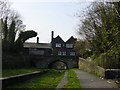
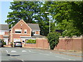
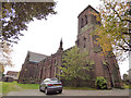
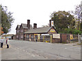
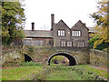
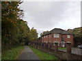
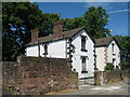
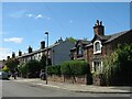
Photos of L11 1ZY

Area Information
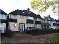
Living in L11 1ZY offers a blend of quiet residential charm and practical connectivity. This small postcode area, home to 1,759 residents, is a compact cluster of houses that caters to a mature demographic, with a median age of 47. Daily life here is shaped by its proximity to key transport links and local amenities. The area’s modest size means a close-knit community feel, where familiar faces and local routines are common. Residents benefit from easy access to rail services and ferry terminals, linking them to nearby cities and beyond. While the population is relatively small, the presence of shops, schools, and public transport ensures convenience without the congestion of larger urban centres. For those seeking a balanced lifestyle, L11 1ZY provides a foundation of stability, with homes predominantly owned by long-term residents. Its low flood risk and absence of environmental constraints make it a pragmatic choice for buyers prioritising safety and simplicity.
- Area Type
- Postcode
- Area Size
- Not available
- Population
- 1759
- Population Density
- 4588 people/km²
The property market in L11 1ZY is dominated by owner-occupied homes, with 71% of residents owning their properties. This high home ownership rate suggests a community of long-term residents rather than a transient rental market. The area’s housing stock consists primarily of houses, which are more common than flats or apartments. Given the small population and compact nature of the postcode, the number of available properties is limited, making the area less suited to those seeking a wide selection of homes. Buyers should consider that the market is likely to be competitive for those prioritising ownership, with fewer new developments or investment opportunities. The presence of houses also implies a focus on family-friendly or spacious living, which may appeal to specific buyer profiles.
House Prices in L11 1ZY
No properties found in this postcode.
Energy Efficiency in L11 1ZY
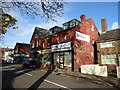
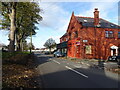
Residents of L11 1ZY have access to a range of essential amenities within practical reach. Local shops include Co-op Darley, Tesco Mill, and M&S Queens, providing everyday groceries and retail needs. The area’s rail stations, such as Broad Green and Roby, offer connections to nearby towns and cities, while ferry terminals like Liverpool Belfast Ferry Terminal Bootle enable travel to destinations across the Irish Sea. These transport links enhance the area’s appeal by facilitating both commuting and leisure activities. The presence of multiple retail and transport options contributes to a convenient lifestyle, reducing the need for long journeys. While the data does not specify parks or leisure facilities, the proximity to rail and ferry services suggests opportunities for recreation and socialising beyond the immediate postcode.
Amenities
Schools
| Rank | School | Type | Entry gender | Ages |
|---|
Explore more schools in this area
Go to Schools tabDemographics
The community in L11 1ZY is predominantly composed of adults aged 30–64, reflecting a median age of 47. This age group suggests a mature population, likely with established careers and families. Home ownership is high, at 71%, indicating a stable residential base with fewer renters. The area is characterised by houses rather than flats, which aligns with the preference for private, larger living spaces. The predominant ethnic group is White, though specific data on diversity is not provided. With no figures on deprivation, it is unclear how economic factors might influence quality of life, but the high home ownership rate suggests a degree of financial security. The absence of younger or older demographics may mean fewer schools catering to children or retirement services, though this is not explicitly stated in the data.
Household Size
Accommodation Type
Tenure
Ethnic Group
Religion
Household Composition
Age
Household Deprivation
NS-SEC
Explore more demographic insights in this area
Go to Demographics tabPlanning
Planning Constraints
- Flood RiskPremium
- Ramsar Wetland SitesPremium
- Area of Outstanding Natural BeautyPremium
- Protected Nature ReservePremium
- Protected WoodlandPremium