Area Overview for L10 8NB
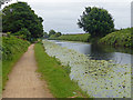
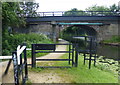
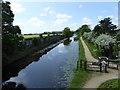
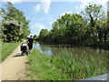
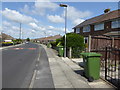
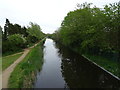
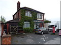
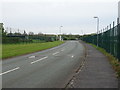
Photos of L10 8NB


Area Information
Living in L10 8NB means being part of a small, tightly knit residential cluster in England with a population of 1360. The area is characterised by its compact size and focus on homeownership, with 90% of properties occupied by their owners. Daily life here is shaped by a mature demographic, with the median age at 47 and the majority of residents falling within the 30-64 age range. The community is predominantly White, and the housing stock consists largely of individual homes rather than flats or apartments. Proximity to Aintree Davenhill Primary School, which holds a good Ofsted rating, makes this area appealing for families. Residents benefit from strong digital connectivity, with broadband rated at the highest possible score, and practical access to rail stations and ferry terminals. The low crime risk and absence of environmental constraints further enhance its appeal as a stable, low-maintenance place to live.
- Area Type
- Postcode
- Area Size
- Not available
- Population
- 1360
- Population Density
- 4242 people/km²
The property market in L10 8NB is dominated by owner-occupied homes, with 90% of properties owned by their residents. This contrasts with areas where rental markets are more prevalent, and it suggests a community focused on long-term stability. The accommodation type is exclusively houses, which is unusual for a small postcode area but may reflect the local planning and land use. Given the compact size of the area, the housing stock is limited, and buyers may need to consider nearby zones for more options. The high home ownership rate implies a competitive market for available properties, but the absence of rental properties means fewer fluctuations in demand. For buyers, this environment offers security but requires careful consideration of the area’s physical boundaries.
House Prices in L10 8NB
No properties found in this postcode.
Energy Efficiency in L10 8NB
The lifestyle in L10 8NB is shaped by its proximity to retail, rail, and ferry amenities. Within walking distance are notable shops such as M&S Aintree, Tesco Aintree, and Morrisons Daily, providing everyday essentials and convenience. The area’s rail network includes five stations, including Old Roan and Aintree, offering connections to broader transport hubs. Ferry terminals like Liverpool Belfast and Liverpool Pier Head are accessible, enabling travel to destinations such as Belfast, the Isle of Man, and Dublin. These amenities contribute to a practical, well-connected daily life, with easy access to shopping, commuting, and regional travel. The mix of retail and transport options supports both routine needs and occasional excursions, enhancing the area’s appeal for a variety of lifestyles.
Amenities
Schools
The nearest school to L10 8NB is Aintree Davenhill Primary School, which serves the local community with a good Ofsted rating. As a primary school, it caters to children aged 4-11, making it a key consideration for families with young children. The absence of secondary schools or further education institutions in the immediate vicinity means parents may need to look slightly beyond the postcode for comprehensive schooling. However, the quality of the primary school suggests a strong foundation for early education. The school’s rating indicates it meets or exceeds national standards in teaching and student outcomes, which is a positive factor for families prioritising educational quality.
| Rank | School | Type | Entry gender | Ages |
|---|
Explore more schools in this area
Go to Schools tabDemographics
The community in L10 8NB is predominantly composed of adults aged 30-64, with a median age of 47. This suggests a population that is largely settled, with fewer young families or elderly residents compared to other areas. Home ownership is exceptionally high at 90%, indicating a strong preference for long-term residency over rental properties. The accommodation type is primarily houses, which aligns with the area’s small, residential character. The predominant ethnic group is White, with no data provided on other ethnicities. While the data does not include specific figures on deprivation, the high home ownership and low crime risk suggest a relatively stable socioeconomic environment. The absence of significant demographic diversity may appeal to those seeking a consistent, familiar community structure.
Household Size
Accommodation Type
Tenure
Ethnic Group
Religion
Household Composition
Age
Household Deprivation
NS-SEC
Explore more demographic insights in this area
Go to Demographics tabPlanning
Planning Constraints
- Flood RiskPremium
- Ramsar Wetland SitesPremium
- Area of Outstanding Natural BeautyPremium
- Protected Nature ReservePremium
- Protected WoodlandPremium