Area Overview for L10 7NY
Photos of L10 7NY


Area Information
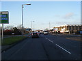
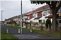
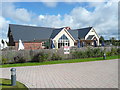
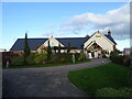
Living in L10 7NY means being part of a small, tightly knit residential cluster in England, home to 1,394 residents. The area’s compact size fosters a quiet, community-focused lifestyle, with no sprawling developments or urban sprawl. It is a place where daily life revolves around local amenities and practical connectivity. With a median age of 47, the population skews towards adults aged 30–64, suggesting a stable, established community. The area’s housing stock is predominantly composed of houses, offering a distinct contrast to high-density living. While the population is small, the proximity to major transport links and retail hubs ensures residents have access to essential services without the need for long commutes. The area’s low flood risk and absence of protected natural sites mean it is free from planning constraints that might complicate development or living. For those seeking a balanced blend of privacy and accessibility, L10 7NY offers a straightforward, no-frills environment.
- Area Type
- Postcode
- Area Size
- Not available
- Population
- 1394
- Population Density
- 8109 people/km²
The property market in L10 7NY is characterised by a low home ownership rate of 34%, implying that most residents are likely to be renters rather than homeowners. The area’s housing stock is predominantly made up of houses, which is unusual for a postcode of this scale, suggesting a mix of older, standalone properties. Given the small population and limited housing supply, the market may be constrained, with fewer options for buyers seeking larger homes or investment opportunities. The low home ownership rate could indicate a reliance on private rental markets or local employment patterns that discourage long-term property purchase. For buyers considering this area, the scarcity of available homes means competition may be fierce, and proximity to nearby towns or cities could be a factor in decision-making. The focus on houses rather than flats or apartments also means the area caters to those prioritising space over density.
House Prices in L10 7NY
No properties found in this postcode.
Energy Efficiency in L10 7NY
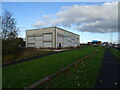
Daily life in L10 7NY is supported by a range of nearby amenities, including retail options such as Co-op Copplehouse, Aldi Fazakerley, and Tesco Fazakerley, which provide essential shopping and grocery needs. These stores are within practical reach, reducing the need for long trips to larger centres. The area’s rail network, with stations like Fazakerley and Kirkby, connects residents to broader regional services, while ferry terminals offer access to maritime routes. Though the area itself is small, its proximity to these amenities ensures a balance between local convenience and external connectivity. The presence of multiple retail outlets and transport hubs suggests a practical, no-nonsense lifestyle, where residents can meet daily needs without excessive travel. The character of the area is defined by its functional approach to living, prioritising accessibility over luxury or novelty.
Amenities
Schools
| Rank | School | Type | Entry gender | Ages |
|---|
Explore more schools in this area
Go to Schools tabDemographics
The community in L10 7NY is largely composed of adults aged 30–64, with a median age of 47. This suggests a population that is neither dominated by young families nor retirees, but rather a mix of middle-aged individuals likely in their prime working years. Home ownership rates are relatively low at 34%, indicating that a majority of residents may rent their homes, possibly due to the area’s limited housing stock or local economic factors. The predominant ethnic group is White, with no specific data provided on other demographics. The absence of detailed diversity statistics means the community’s composition is not explicitly defined beyond this. The area’s small population of 1,394 residents ensures a close-knit environment, though it may lack the cultural or social diversity found in larger urban centres. The age profile and home ownership figures suggest a pragmatic, settled population focused on stability over rapid change.
Household Size
Accommodation Type
Tenure
Ethnic Group
Religion
Household Composition
Age
Household Deprivation
NS-SEC
Explore more demographic insights in this area
Go to Demographics tabPlanning
Planning Constraints
- Flood RiskPremium
- Ramsar Wetland SitesPremium
- Area of Outstanding Natural BeautyPremium
- Protected Nature ReservePremium
- Protected WoodlandPremium