Area Overview for L10 6NL
Photos of L10 6NL


Area Information
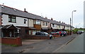
L10 6NL is a compact residential postcode area in England, covering just 1373 m² and home to 1300 residents. Its high population density of 947146 people per km² reflects a tightly packed community, where proximity to amenities and services is a defining feature. The area’s small size means it is likely a single, cohesive neighbourhood with limited expansion potential. Daily life here is shaped by its residential character, with homes predominantly in private ownership. The area’s proximity to transport links and retail hubs suggests it is well-served for both practical needs and convenience. While its size is modest, the density implies a strong sense of local identity, with residents likely accustomed to a close-knit environment. For buyers, this area offers a blend of stability and accessibility, though its limited footprint means opportunities for development may be constrained. The presence of nearby schools, rail stations, and ferry terminals further cements its appeal as a practical location for families and commuters alike.
- Area Type
- Postcode
- Area Size
- 1373 m²
- Population
- 1300
- Population Density
- 2169 people/km²
L10 6NL is predominantly a home-ownership area, with 78% of residents owning their properties. The accommodation type is largely houses, which implies a focus on private, family-oriented living rather than rental apartments or shared housing. This suggests a market where property values are likely to be stable, with limited turnover due to the high proportion of long-term owners. The small size of the area means the housing stock is limited, and buyers may need to consider nearby postcode areas for more options. The prevalence of houses could also indicate a preference for larger properties, which may appeal to families or those seeking space. However, the compact nature of the area may mean that property availability is constrained, making it a competitive market for buyers. For those seeking investment, the high home ownership rate suggests a low likelihood of rental demand, though proximity to transport links could enhance property desirability.
House Prices in L10 6NL
No properties found in this postcode.
Energy Efficiency in L10 6NL
Residents of L10 6NL have access to a range of nearby amenities, including retail outlets such as Morrisons Daily, Tesco Aintree, and M&S Aintree. These shops provide everyday essentials, making it convenient for residents to manage household needs without traveling far. The area’s proximity to rail stations like Old Roan, Fazakerley, and Aintree, as well as ferry terminals such as Liverpool Belfast Ferry Terminal Bootle, adds to its connectivity. While the data does not mention parks or leisure facilities, the presence of multiple retail and transport options suggests a practical, service-oriented lifestyle. The compact nature of the area means amenities are within easy reach, fostering a sense of convenience and accessibility. For those who enjoy shopping, commuting, or using public transport, L10 6NL offers a straightforward, efficient environment.
Amenities
Schools
The nearest school to L10 6NL is Holy Rosary Catholic Primary School, which has an Ofsted rating of good. This school serves the primary education needs of the area, though no secondary schools are listed in the data. The presence of a primary school with a good rating indicates a solid foundation for families with young children, though parents may need to look further afield for secondary education options. The single school listed suggests a limited range of educational choices, which could be a consideration for families prioritising a variety of school types. The quality of the primary school, however, provides reassurance for those seeking a reliable local institution.
| Rank | School | Type | Entry gender | Ages |
|---|
Explore more schools in this area
Go to Schools tabDemographics
The population of L10 6NL skews towards adults aged 30-64, with a median age of 47. This suggests a mature, established community with a focus on long-term residency. Home ownership is high at 78%, indicating a stable housing market where most residents are likely to have purchased their homes rather than rented. The predominant accommodation type is houses, which aligns with the area’s residential character and may reflect a preference for larger, family-friendly properties. The predominant ethnic group is White, though no specific data on diversity or deprivation levels is provided. The high population density, while not uncommon for urban areas, may influence the character of daily life, fostering a sense of community but also potentially limiting space for new developments. The age profile suggests a mix of working professionals and families, with fewer younger or elderly residents compared to other areas.
Household Size
Accommodation Type
Tenure
Ethnic Group
Religion
Household Composition
Age
Household Deprivation
NS-SEC
Explore more demographic insights in this area
Go to Demographics tabPlanning
Planning Constraints
- Flood RiskPremium
- Ramsar Wetland SitesPremium
- Area of Outstanding Natural BeautyPremium
- Protected Nature ReservePremium
- Protected WoodlandPremium