Area Overview for L10 4XW
Photos of L10 4XW
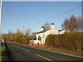


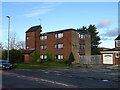

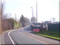

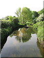
19 photos from this area
Area Information
Key information about the L10 4XW including its size, population, and administrative classification.
- Area Type
- Postcode
- Area Size
- 5605 m²
- Population
- 1338
- Population Density
- 4804 people/km²
House Prices in L10 4XW
25
Properties
£95,562
Average Sold Price
£1,170
Lowest Price
£220,000
Highest Price
Showing 25 properties
| Address | Type | Beds | Baths | Last Sale Price | Last Sale Date | |
|---|---|---|---|---|---|---|
| 4 Elizabeth Road, Field Lane Estate, L10 4XW | Detached | 3 | 1 | £220,000 | Aug 2025 | |
| 26 Elizabeth Road, Field Lane Estate, L10 4XW | Semi-detached | 3 | - | £145,000 | Feb 2025 | |
| 6 Elizabeth Road, Field Lane Estate, L10 4XW | Semi-detached | 3 | 1 | £86,000 | Dec 2020 | |
| 44 Elizabeth Road, Field Lane Estate, L10 4XW | Semi-detached | 3 | 1 | £1,170 | May 2018 | |
| 32 Elizabeth Road, Field Lane Estate, L10 4XW | house | - | - | £72,000 | Sep 2016 | |
| 34 Elizabeth Road, Field Lane Estate, L10 4XW | Semi-detached | 3 | 1 | £94,950 | Oct 2006 | |
| 30 Elizabeth Road, Field Lane Estate, L10 4XW | Terraced | - | - | £92,500 | Nov 2005 | |
| 8 Elizabeth Road, Field Lane Estate, L10 4XW | house | - | - | £118,000 | Jul 2005 | |
| 2 Elizabeth Road, Field Lane Estate, L10 4XW | Semi-detached | - | - | £100,000 | Jun 2004 | |
| 40 Elizabeth Road, Field Lane Estate, L10 4XW | Terraced | - | - | £26,000 | May 1999 |
Page 1 of 3
Energy Efficiency in L10 4XW
Amenities
Schools
| Rank | School | Type | Entry gender | Ages |
|---|
Explore more schools in this area
Go to Schools tabDemographics
Household Size
Two person
most common
Accommodation Type
Houses
most common
Tenure
72
majority
Ethnic Group
White
most common
Religion
N/A
most common
Household Composition
N/A
most common
Age
47
median
Adults (30-64 years)
most common
Household Deprivation
N/A
with no deprivation
NS-SEC
22
in Lower managerial occupations
Explore more demographic insights in this area
Go to Demographics tabPlanning
Planning Constraints
- Flood RiskPremium
- Ramsar Wetland SitesPremium
- Area of Outstanding Natural BeautyPremium
- Protected Nature ReservePremium
- Protected WoodlandPremium