Area Overview for L10 4UF
Photos of L10 4UF
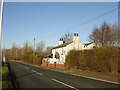

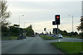


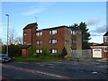

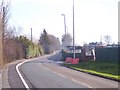
19 photos from this area
Area Information
Key information about the L10 4UF including its size, population, and administrative classification.
- Area Type
- Postcode
- Area Size
- 2.3 hectares
- Population
- 1377
- Population Density
- 1179 people/km²
House Prices in L10 4UF
59
Properties
£100,437
Average Sold Price
£43,995
Lowest Price
£200,000
Highest Price
Showing 59 properties
| Address | Type | Beds | Baths | Last Sale Price | Last Sale Date | |
|---|---|---|---|---|---|---|
| 47 Horseshoe Drive, Field Lane Estate, L10 4UF | Semi-detached | 3 | 1 | £185,000 | Apr 2024 | |
| 49 Horseshoe Drive, Field Lane Estate, L10 4UF | Detached | 3 | 1 | £200,000 | Dec 2022 | |
| 60 Horseshoe Drive, Field Lane Estate, L10 4UF | Terraced | 3 | 1 | £140,000 | Sep 2021 | |
| 17 Horseshoe Drive, Field Lane Estate, L10 4UF | Detached | 3 | 3 | £181,000 | Jul 2020 | |
| 12 Horseshoe Drive, Field Lane Estate, L10 4UF | Semi-detached | 3 | 1 | £115,000 | Nov 2019 | |
| 22 Horseshoe Drive, Field Lane Estate, L10 4UF | Semi-detached | 2 | 1 | £90,000 | Sep 2019 | |
| 29 Horseshoe Drive, Field Lane Estate, L10 4UF | Semi-detached | 3 | 1 | £139,000 | Sep 2019 | |
| 38 Horseshoe Drive, Field Lane Estate, L10 4UF | Detached | 3 | 2 | £177,000 | Jun 2019 | |
| 64 Horseshoe Drive, Field Lane Estate, L10 4UF | Semi-detached | 3 | 1 | £125,000 | Mar 2019 | |
| 21 Horseshoe Drive, Field Lane Estate, L10 4UF | Detached | 3 | 1 | £139,000 | Sep 2017 |
Page 1 of 6
Energy Efficiency in L10 4UF
Amenities
Schools
| Rank | School | Type | Entry gender | Ages |
|---|
Explore more schools in this area
Go to Schools tabDemographics
Household Size
Family (3-5 people)
most common
Accommodation Type
Houses
most common
Tenure
61
majority
Ethnic Group
White
most common
Religion
N/A
most common
Household Composition
N/A
most common
Age
47
median
Adults (30-64 years)
most common
Household Deprivation
N/A
with no deprivation
NS-SEC
21
in Lower managerial occupations
Explore more demographic insights in this area
Go to Demographics tabPlanning
Planning Constraints
- Flood RiskPremium
- Ramsar Wetland SitesPremium
- Area of Outstanding Natural BeautyPremium
- Protected Nature ReservePremium
- Protected WoodlandPremium