Area Overview for L10 3LP
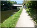
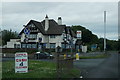
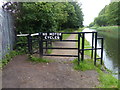
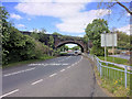
Photos of L10 3LP


Area Information
Living in L10 3LP means residing in a small, tightly knit residential cluster in England, where the population of 1620 people is spread across a density of 228 per square kilometre. This area is characterised by its compact nature, offering a balance between suburban comfort and proximity to essential services. The community is largely composed of adults aged 30–64, reflecting a mature demographic that values stability and established living. Daily life here is shaped by the availability of nearby retail, transport, and ferry connections, which make it practical for both local and regional travel. The area’s low flood risk and absence of protected natural sites mean development is not constrained by environmental restrictions, allowing for straightforward planning. While the population is small, the presence of five retail outlets, including Asda Aintree and Tesco Aintree, ensures basic needs are met. For those prioritising connectivity, the postcode’s proximity to rail stations like Old Roan and Aintree provides regular links to major cities, while ferry terminals offer access to nearby islands and ports. This combination of practicality and accessibility makes L10 3LP a viable option for those seeking a manageable, service-rich environment.
- Area Type
- Postcode
- Area Size
- Not available
- Population
- 1620
- Population Density
- 228 people/km²
The property market in L10 3LP is primarily owner-occupied, with 75% of residents owning their homes. This high rate of home ownership suggests a stable market where properties are likely to remain in private hands rather than being rented out. The accommodation type is predominantly houses, which is unusual for areas with higher population densities but aligns with the area’s low population of 1620. This housing stock may cater to families or individuals seeking more space than a flat would provide. Given the small size of the area, the property market is likely limited in scale, with limited scope for new developments. Buyers should consider that the area’s compact nature means competition for properties could be fierce, and the surrounding immediate area may offer more options. The lack of protected natural sites or planning constraints may also make it easier to purchase without restrictions, though the small population suggests a niche market.
House Prices in L10 3LP
No properties found in this postcode.
Energy Efficiency in L10 3LP
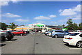
Residents of L10 3LP benefit from a range of nearby amenities that cater to daily needs. Five retail outlets, including Asda Aintree, Tesco Aintree, and Aldi 5, provide access to groceries, household goods, and convenience shopping. The area’s rail network, with stations like Old Roan and Aintree, offers regular connections to urban centres, while ferry terminals provide direct links to the Isle of Man, Belfast, and Dublin. This mix of retail and transport options ensures a practical lifestyle, reducing the need for long commutes. While the area lacks large parks or leisure facilities, the absence of protected natural sites means development is not restricted, potentially allowing for future expansion of amenities. The presence of multiple retail and transport hubs suggests a community that values accessibility and convenience, making it suitable for those who prioritise ease of movement over expansive green spaces.
Amenities
Schools
| Rank | School | Type | Entry gender | Ages |
|---|
Explore more schools in this area
Go to Schools tabDemographics
The community in L10 3LP is predominantly composed of adults aged 30–64, with a median age of 47. This suggests a mature population, likely with established careers and families. Home ownership is high, with 75% of residents owning their homes, indicating a stable and long-term resident base. The area is characterised by houses rather than flats, which aligns with the demographic’s preference for family-friendly living. The predominant ethnic group is White, reflecting a homogeneous community. While no specific deprivation data is provided, the high home ownership rate and age profile suggest a relatively secure economic environment. However, the absence of detailed diversity metrics means the full range of cultural or socioeconomic characteristics remains unexplored. The area’s compact size and mature age profile contribute to a quiet, low-traffic residential atmosphere, which may appeal to those seeking a settled lifestyle over dynamic urban growth.
Household Size
Accommodation Type
Tenure
Ethnic Group
Religion
Household Composition
Age
Household Deprivation
NS-SEC
Explore more demographic insights in this area
Go to Demographics tabPlanning
Planning Constraints
- Flood RiskPremium
- Ramsar Wetland SitesPremium
- Area of Outstanding Natural BeautyPremium
- Protected Nature ReservePremium
- Protected WoodlandPremium