Area Overview for L1 9HZ
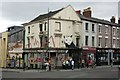
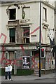
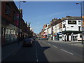
Photos of L1 9HZ

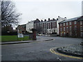


Area Information
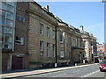
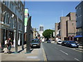
Living in L1 9HZ means being part of a small, tightly knit residential cluster in England, home to 2,403 people. This postcode is characterised by its compact nature, with a population skewed heavily towards young adults aged 15–29. The area’s proximity to multiple schools, transport hubs, and retail outlets makes it practical for daily life, though its small size means it is not a sprawling suburb. Residents benefit from nearby primary schools, including Pleasant Street Primary School, which holds a ‘good’ Ofsted rating, and access to rail networks like Liverpool Lime Street station. However, the area’s high crime risk score—1 out of 100—demands attention to security. Despite this, L1 9HZ offers a mix of convenience and affordability, with a predominance of flats and a rental-focused market. For those prioritising connectivity, mobile coverage is strong, but broadband speeds are below average. This postcode is ideal for those seeking proximity to urban amenities without the sprawl of larger cities.
- Area Type
- Postcode
- Area Size
- Not available
- Population
- 2403
- Population Density
- 5816 people/km²
The property market in L1 9HZ is predominantly rental-focused, with only 12% of homes owned by residents. This suggests a high reliance on private rented accommodation, which is unusual for a small postcode area. The accommodation type is almost exclusively flats, reflecting a lack of larger family homes or detached properties. For buyers, this means limited opportunities for owner-occupation within the immediate area, and any purchases would likely require looking beyond L1 9HZ’s boundaries. The small size of the postcode also means that housing stock is constrained, with no indication of new developments or significant expansion. Potential buyers should consider the area’s rental dynamics and the challenges of finding owner-occupied properties, particularly if they prioritise long-term investment. The flat-dominated market may appeal to those seeking short-term or flexible living arrangements but may not suit families or those seeking larger homes.
House Prices in L1 9HZ
No properties found in this postcode.
Energy Efficiency in L1 9HZ
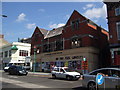
Residents of L1 9HZ have access to a variety of amenities within practical reach, enhancing daily life. Retail options include Co-op Leece, Tesco Liverpool, and Co-op Liverpool, providing essential shopping needs. The area’s rail network connects to major stations, while ferry terminals like Liverpool Pier Head and Woodside Birkenhead offer links to nearby destinations. These transport links are complemented by the presence of multiple schools, making it convenient for families. The mix of retail, transport, and educational facilities contributes to a functional lifestyle, though the area’s small size means amenities are concentrated rather than spread out. The availability of supermarkets and transport hubs ensures that residents can meet their needs without long commutes, though the lack of leisure or recreational facilities is notable. This postcode is suited to those prioritising practicality over expansive leisure options.
Amenities
Schools
Residents of L1 9HZ have access to a range of educational institutions, from primary schools to higher education. Pleasant Street Primary School, with a ‘good’ Ofsted rating, serves younger children, while St Nicholas’s Catholic Primary School and St Nicholas RC Infant School provide additional primary options. For secondary education, The City of Liverpool College offers sixth-form provision, and Liverpool John Moores University is nearby, catering to higher education needs. This mix of school types ensures that families with children at different stages of education can find suitable options within a short distance. The presence of multiple primary schools may reduce competition for places, though the absence of secondary schools within the postcode itself means students may need to travel for senior education. The proximity to higher education institutions also makes the area attractive to those seeking to study or work in the sector.
| Rank | School | Type | Entry gender | Ages |
|---|
Explore more schools in this area
Go to Schools tabDemographics
The community in L1 9HZ is overwhelmingly young, with a median age of 22 and 12% of residents owning their homes. This low home ownership rate suggests a rental market dominated by flats, which are the primary accommodation type. The population is predominantly White, with no data provided on other ethnic groups. The age profile indicates a focus on young adults, likely students or early-career professionals, given the proximity to Liverpool John Moores University. The area’s limited size and youthful demographic contribute to a dynamic but transient community. While no specific data on deprivation is available, the high crime risk score of 1/100 implies challenges in safety that could impact quality of life. This profile makes L1 9HZ distinct from more established or family-oriented neighbourhoods, with its appeal rooted in affordability and accessibility rather than long-term stability.
Household Size
Accommodation Type
Tenure
Ethnic Group
Religion
Household Composition
Age
Household Deprivation
NS-SEC
Explore more demographic insights in this area
Go to Demographics tabPlanning
Planning Constraints
- Flood RiskPremium
- Ramsar Wetland SitesPremium
- Area of Outstanding Natural BeautyPremium
- Protected Nature ReservePremium
- Protected WoodlandPremium