Area Overview for L1 9AT
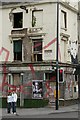
Photos of L1 9AT


Area Information
Living in L1 9AT means being part of a small, tightly knit residential cluster in England with a population of 1458. The area is defined by its compact size and proximity to key urban infrastructure, making it a practical choice for those seeking convenience without the sprawl of larger towns. The community is predominantly young, with a median age of 22 and most residents falling into the 15–29 age bracket. This demographic suggests a mix of students, early-career professionals, and young families. The housing stock is largely composed of flats, reflecting a rental-oriented market rather than owner-occupied properties. While the area lacks natural landscapes or protected sites, its strategic location near transport hubs and retail amenities ensures daily life is efficient. Residents benefit from nearby schools, rail networks, and ferry services, which connect them to Liverpool’s broader economy and cultural offerings. The compact nature of L1 9AT means that most essentials are within walking distance, though the small population size means community events and local businesses may be limited compared to larger areas.
- Area Type
- Postcode
- Area Size
- Not available
- Population
- 1458
- Population Density
- 9980 people/km²
The property market in L1 9AT is dominated by rental flats, with only 22% of homes owned by residents. This suggests a market that is not primarily owner-occupied, likely catering to students, young professionals, and those seeking short-term housing. The prevalence of flats indicates smaller, more compact living spaces, which may appeal to those prioritising affordability and proximity to urban amenities. However, the low home ownership rate also means limited opportunities for long-term investment or equity growth. For buyers, the small size of the area and its focus on rental properties may mean competition is limited, but the housing stock is unlikely to include larger family homes or detached properties. The immediate surroundings offer similar characteristics, reinforcing that L1 9AT is best suited for those seeking transient or budget-friendly housing rather than permanent family residences.
House Prices in L1 9AT
Showing 1 properties
| Address | Type | Beds | Baths | Last Sale Price | Last Sale Date | |
|---|---|---|---|---|---|---|
| 51 Rodney Street, Liverpool, L1 9AT | Retail | - | - | - | - |
Energy Efficiency in L1 9AT
Residents of L1 9AT enjoy access to a range of amenities within practical reach, including retail, transport, and leisure options. The area is served by five retail outlets, including Co-op Leece and Tesco Liverpool, providing essential shopping and grocery services. Rail networks such as Liverpool Central Loop Line and Liverpool James Street Railway Station offer frequent connections to Liverpool’s city centre and beyond, while ferry terminals at Liverpool Pier Head and Woodside Birkenhead provide links to nearby towns and the Isle of Man. These transport options enhance mobility, making it easy to commute or travel for leisure. The presence of multiple retail and transport hubs suggests a practical, urban lifestyle with limited green spaces but strong connectivity to larger urban amenities. The compact nature of the area means that most needs can be met locally, though the small population size may limit the variety of local businesses or community events.
Amenities
Schools
Residents of L1 9AT have access to three schools within practical reach. Elliott-Clarke School is an independent institution, offering a fee-paying alternative for families seeking private education. City College is categorised as “other,” which may include further education or vocational training providers. Lipa School is an academy with an Ofsted rating of satisfactory, indicating it meets basic standards but may not excel in areas such as student outcomes or leadership. The mix of school types provides options for families, from state-funded academies to independent institutions, though the limited diversity of school types may restrict choices for those seeking specialist provision. The satisfactory rating at Lipa School suggests it is functional but not outstanding, which could be a consideration for parents prioritising high-performing education.
| Rank | School | Type | Entry gender | Ages |
|---|
Explore more schools in this area
Go to Schools tabDemographics
The community in L1 9AT is overwhelmingly young, with 22% of residents aged 15–29, reflecting a demographic skewed towards students and young professionals. Home ownership is low at 22%, indicating that most residents rent their accommodation. The area is characterised by flats, which dominate the housing stock, suggesting a focus on smaller, more affordable living spaces. The predominant ethnic group is White, though no specific data on diversity or deprivation levels is provided. This age profile and housing type imply a transient population, with limited long-term residency. The low home ownership rate may also suggest a reliance on rental markets, which could impact stability for those seeking long-term housing. The absence of data on deprivation means that quality of life factors such as access to services or income levels cannot be fully assessed, but the presence of nearby schools and transport links suggests some level of infrastructure support.
Household Size
Accommodation Type
Tenure
Ethnic Group
Religion
Household Composition
Age
Household Deprivation
NS-SEC
Explore more demographic insights in this area
Go to Demographics tabPlanning
Planning Constraints
- Flood RiskPremium
- Ramsar Wetland SitesPremium
- Area of Outstanding Natural BeautyPremium
- Protected Nature ReservePremium
- Protected WoodlandPremium