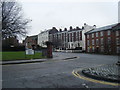
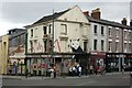
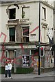
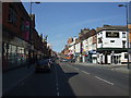
Area Overview for L1 4JD
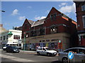
Photos of L1 4JD


Area Information
Living in L1 4JD means being part of a small, tightly knit residential cluster in England, home to 1,458 people. This area is defined by its compact size and practical accessibility to urban amenities. The community is young, with a median age of 22 and most residents falling between 15 and 29 years old. Daily life here is shaped by the prevalence of flats, which dominate the housing stock, and a rental-focused market where only 22% of homes are owner-occupied. Despite its small footprint, the area offers proximity to essential services, including retail hubs, rail networks, and ferry terminals. The presence of three schools—Elliott-Clarke School, City College, and Lipa School—cater to different educational needs, though the latter carries a satisfactory Ofsted rating. While flood risk is negligible, residents should be mindful of the area’s high crime risk, which ranks among the worst in the region. L1 4JD is not for those seeking luxury or isolation; it is a pragmatic choice for those prioritising connectivity and affordability in a dynamic, youthful environment.
- Area Type
- Postcode
- Area Size
- Not available
- Population
- 1458
- Population Density
- 9980 people/km²
The property market in L1 4JD is characterised by a high proportion of rental properties, with only 22% of homes owned by residents. This suggests a market skewed towards tenants rather than owner-occupiers, which may reflect the area’s youthful population and limited long-term residency. Flats dominate the housing stock, a common feature in smaller, urbanised clusters. For buyers, this means a limited selection of properties, with most options likely to be flats rather than detached or semi-detached homes. The compact nature of the area also means that property values may be influenced more by proximity to transport links and amenities than by traditional factors like land size. Investors or buyers seeking owner-occupied properties may find the market challenging, given the low home ownership rate and the prevalence of rental units.
House Prices in L1 4JD
No properties found in this postcode.
Energy Efficiency in L1 4JD
Residents of L1 4JD enjoy proximity to essential retail and transport hubs. Nearby supermarkets include Tesco Liverpool, Co-op Leece, and Sainsburys Liverpool, ensuring easy access to groceries and daily necessities. The rail network is extensive, with five stations offering connections to Liverpool’s central loop and mainline services, while ferry terminals provide links to Birkenhead and Dublin. These transport options enhance mobility, making commuting or leisure travel straightforward. The area’s compact size means amenities are within practical reach, though the focus on retail and transport over leisure or green spaces suggests a utilitarian lifestyle. For those prioritising convenience over expansive recreational areas, L1 4JD delivers a functional, accessible environment.
Amenities
Schools
Residents of L1 4JD have access to three schools: Elliott-Clarke School, an independent institution; City College, which falls under a different category; and Lipa School, an academy with a satisfactory Ofsted rating. The mix of school types offers families varied options, from private education to state-funded institutions. Elliott-Clarke’s independent status may appeal to those seeking structured, fee-based education, while Lipa’s satisfactory rating indicates it meets basic standards but may lack outstanding features. City College, classified as ‘other’, could include further education or vocational training. This diversity allows families to choose based on their priorities, though the absence of higher-rated schools may be a concern for those seeking excellence in education.
| Rank | School | Type | Entry gender | Ages |
|---|
Explore more schools in this area
Go to Schools tabDemographics
The community in L1 4JD is overwhelmingly young, with a median age of 22 and the majority of residents aged 15–29. This demographic profile suggests a population largely composed of students, early-career professionals, or those in transient employment. Home ownership is low at 22%, indicating that most residents rent their accommodation. Flats are the predominant housing type, reflecting a preference for compact living in a densely populated area. The predominant ethnic group is White, though no specific data on diversity beyond this is provided. The low home ownership rate and young age profile suggest a transient community, where long-term stability may be less common. Quality of life is influenced by this demographic structure, with amenities and services likely tailored to younger, mobile residents. The absence of detailed diversity statistics means the full scope of cultural or social dynamics remains unexplored.
Household Size
Accommodation Type
Tenure
Ethnic Group
Religion
Household Composition
Age
Household Deprivation
NS-SEC
Explore more demographic insights in this area
Go to Demographics tabPlanning
Planning Constraints
- Flood RiskPremium
- Ramsar Wetland SitesPremium
- Area of Outstanding Natural BeautyPremium
- Protected Nature ReservePremium
- Protected WoodlandPremium