Area Overview for L1 3EG
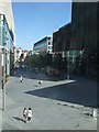
Photos of L1 3EG


Area Information
Living in L1 3EG means being part of a small, tightly knit residential cluster in England, home to just over 1,000 people. The area’s compact size fosters a sense of community, though its limited population suggests a modest scale of daily life. With a median age of 22 and a majority of residents aged 15–29, this postcode is dominated by young adults, many of whom may be students or early-career professionals. The housing stock is almost entirely flats, reflecting a rental-heavy market. While the area lacks the density of larger urban centres, its proximity to Liverpool’s transport networks and retail hubs offers convenience. Residents benefit from nearby rail services, ferry terminals, and supermarkets, making it practical for both daily errands and commuting. However, the small footprint of L1 3EG means its immediate surroundings are limited, requiring residents to venture further for broader amenities. The area’s character is defined by its youthful demographic and reliance on shared spaces, though its modest size may not appeal to those seeking expansive living environments.
- Area Type
- Postcode
- Area Size
- Not available
- Population
- 1014
- Population Density
- 2172 people/km²
The property market in L1 3EG is characterised by a high proportion of rental properties, with only 30% of homes owner-occupied. Flats dominate the housing stock, reflecting a focus on compact, affordable living spaces. This suggests the area is more suited to renters than buyers seeking long-term ownership, particularly given its small size and limited expansion potential. The concentration of flats may also indicate a higher demand for shared spaces or proximity to urban centres, aligning with the area’s young demographic. For buyers, the scarcity of owner-occupied homes means competition for available properties is likely fierce, and the market may be more speculative than stable. Those considering purchase should factor in the area’s modest scale and the potential for limited future appreciation, as the immediate surroundings offer little in the way of additional housing stock.
House Prices in L1 3EG
No properties found in this postcode.
Energy Efficiency in L1 3EG
Residents of L1 3EG have access to a range of nearby amenities that support daily life. Retail options include major chains such as M&S Liverpool, Tesco Liverpool, and Tesco Clayton, offering convenience for shopping and essentials. The area’s rail network, with stations like Liverpool Central Loop Line and Moorfields Railway Station, provides efficient links to the city centre and beyond, while ferry terminals at Liverpool Pier Head and Woodside Birkenhead offer alternative routes for travel. These transport options are complemented by the proximity of leisure and commercial hubs, making the area practical for both work and recreation. The availability of supermarkets, combined with easy access to public transport, suggests a lifestyle focused on accessibility and efficiency. However, the limited local amenities mean residents may need to travel further for more specialised services or entertainment.
Amenities
Schools
| Rank | School | Type | Entry gender | Ages |
|---|
Explore more schools in this area
Go to Schools tabDemographics
L1 3EG’s population of 1,014 is overwhelmingly young, with a median age of 22 and the majority of residents falling within the 15–29 age range. This demographic skew suggests a community of students, recent graduates, or young professionals, many of whom may be renting rather than owning. Only 30% of homes are owner-occupied, with flats being the predominant accommodation type. The area’s ethnic composition is predominantly White, though no specific data on diversity or deprivation levels is provided. The high proportion of young adults indicates a dynamic but transient population, which may influence local services and amenities. For buyers, this profile suggests a market tailored to short-term stays or investment in rental properties rather than long-term family homes. The absence of detailed diversity metrics means the community’s social fabric remains partially unexplored in the data.
Household Size
Accommodation Type
Tenure
Ethnic Group
Religion
Household Composition
Age
Household Deprivation
NS-SEC
Explore more demographic insights in this area
Go to Demographics tabPlanning
Planning Constraints
- Flood RiskPremium
- Ramsar Wetland SitesPremium
- Area of Outstanding Natural BeautyPremium
- Protected Nature ReservePremium
- Protected WoodlandPremium