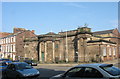
Area Overview for L1 1JE
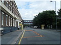
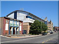
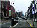
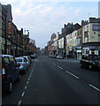
Photos of L1 1JE


Area Information
Living in L1 1JE means inhabiting a tightly packed residential cluster in England, where 2,478 people reside across just 2,449 square metres. This density creates a compact, high-traffic environment, with residents navigating a mix of urban and commuter-focused living. The area’s proximity to Liverpool Lime Street Low Level Railway Station and Seacombe Ferry Terminal ensures easy access to both rail and maritime transport, linking residents to broader regional networks. Daily life here is shaped by its young demographic—over half the population are aged 15–29—suggesting a community leaning towards students, young professionals, or those in transient employment. The area’s small size means amenities are concentrated, with retail options like Tesco and Sainsburys within walking distance. While the population density is extreme, the area’s limited footprint ensures a focus on immediate surroundings, making it a practical choice for those prioritising transport links over sprawling suburban living.
- Area Type
- Postcode
- Area Size
- 2449 m²
- Population
- 2478
- Population Density
- 6665 people/km²
The property market in L1 1JE is characterised by a low home ownership rate of 14%, with flats comprising the majority of housing stock. This suggests a rental-dominated market, where long-term ownership is rare. The area’s small size—just 2,449 square metres—means housing options are limited, with little scope for expansion or development. For buyers, this presents challenges: the scarcity of owner-occupied properties may push prospective buyers to consider adjacent areas with more available stock. Flats in L1 1JE are likely to be smaller, with shared walls and communal spaces, reflecting the area’s density. Given the high proportion of young renters, properties here may be more suited to short-term stays or investment in rental yields rather than family homes. Buyers should also consider the area’s proximity to transport links as a key selling point, though the lack of private ownership opportunities may deter those seeking long-term stability.
House Prices in L1 1JE
Showing 1 properties
| Address | Type | Beds | Baths | Last Sale Price | Last Sale Date | |
|---|---|---|---|---|---|---|
| 11 Lime Street, Liverpool, L1 1JE | Retail | - | - | - | - |
Energy Efficiency in L1 1JE
Residents of L1 1JE have access to a range of practical amenities within walking distance. Retail options include major chains like Tesco and Sainsburys, as well as M&S at Liverpool Lime Street Rail Station, offering convenience for daily shopping. The area’s proximity to rail and ferry terminals means public transport is a central feature of daily life, with Liverpool Central Loop Line and Seacombe Ferry Terminal providing regular services. While parks or leisure facilities are not explicitly mentioned in the data, the concentration of retail and transport hubs suggests a lifestyle focused on efficiency rather than expansive recreational spaces. The presence of multiple retail outlets and transport nodes indicates a community prioritising accessibility over sprawling amenities, with a clear emphasis on connectivity and immediate practical needs.
Amenities
Schools
| Rank | School | Type | Entry gender | Ages |
|---|
Explore more schools in this area
Go to Schools tabDemographics
L1 1JE’s population skews heavily towards young adults, with a median age of 22 and 68% of residents falling into the 15–29 age bracket. This demographic profile suggests a community dominated by students, recent graduates, or those in temporary work, reflecting a transient lifestyle. Home ownership is exceptionally low at 14%, with flats being the predominant accommodation type. This indicates a rental-heavy market, likely driven by the area’s compact size and proximity to transport hubs. The predominant ethnic group is White, though specific diversity metrics are not provided. The high proportion of young people may correlate with lower long-term investment in property, as residents may prioritise mobility over permanence. The area’s demographic makeup shapes its social dynamics, with a focus on short-term tenancies and shared living arrangements.
Household Size
Accommodation Type
Tenure
Ethnic Group
Religion
Household Composition
Age
Household Deprivation
NS-SEC
Explore more demographic insights in this area
Go to Demographics tabPlanning
Planning Constraints
- Flood RiskPremium
- Ramsar Wetland SitesPremium
- Area of Outstanding Natural BeautyPremium
- Protected Nature ReservePremium
- Protected WoodlandPremium