Area Overview for L1 1DF
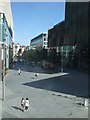
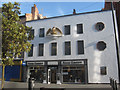
Photos of L1 1DF


Area Information
Living in L1 1DF means inhabiting one of the most densely populated residential clusters in England. The area spans just 5,444 square metres, housing 2,478 residents in a compact footprint. With a population density of 455,167 people per square kilometre, the community is tightly knit, though the small size means limited space for expansion. This postcode is defined by its proximity to key transport networks, including five railway stations and ferry terminals, which connect residents to Liverpool’s city centre and beyond. Daily life here is shaped by the area’s youthful demographic, with a median age of 22 and most residents aged 15–29. The high concentration of flats suggests a mix of student housing and rental properties, reflecting the area’s role as a transient hub. While the dense population may create a lively atmosphere, it also means limited green space and a reliance on nearby amenities for leisure and shopping. For those prioritising connectivity over open space, L1 1DF offers swift access to retail, transport, and waterfront locations, though the broadband infrastructure remains a challenge.
- Area Type
- Postcode
- Area Size
- 5444 m²
- Population
- 2478
- Population Density
- 6665 people/km²
The property market in L1 1DF is characterised by a low rate of home ownership, with only 14% of residents owning their homes. This suggests a rental-dominated market, where flats are the primary accommodation type. The area’s compact size and high population density mean that housing stock is limited, with little scope for new developments. For buyers, this creates a challenging landscape: the small footprint of the postcode means competition for available properties, and the prevalence of flats may not appeal to those seeking larger or more private spaces. The rental market is likely to be competitive, with landlords targeting students and young professionals who prioritise proximity to transport and amenities over property size. Buyers considering the area should weigh the advantages of its connectivity against the constraints of its small scale and lack of private housing options. The surrounding area may offer more varied choices, but proximity to L1 1DF’s transport links remains a key draw.
House Prices in L1 1DF
Showing 1 properties
| Address | Type | Beds | Baths | Last Sale Price | Last Sale Date | |
|---|---|---|---|---|---|---|
| 35A, Compton House, Church Street, Liverpool, L1 1DF | Office | - | - | - | - |
Energy Efficiency in L1 1DF
Residents of L1 1DF have access to a range of retail, transport, and waterfront amenities within practical reach. Five retail outlets, including Tesco Clayton and Iceland Williamson, provide everyday shopping options, while nearby Tesco Liverpool serves as a larger supermarket hub. The area’s transport network is extensive, with five railway stations offering connections to Liverpool’s city centre and beyond. Ferry terminals at Liverpool Pier Head and Woodside Birkenhead provide direct links to the Isle of Man, Dublin, and Birkenhead, enhancing mobility for commuters and leisure travellers. While the area lacks significant green spaces or parks, its proximity to the waterfront and transport hubs offers alternative leisure opportunities. The dense population and compact layout mean social interactions are frequent, though the lack of private outdoor space may require residents to seek recreational activities elsewhere. The combination of retail, transport, and ferry access creates a convenient, though small-scale, lifestyle centred on connectivity and accessibility.
Amenities
Schools
| Rank | School | Type | Entry gender | Ages |
|---|
Explore more schools in this area
Go to Schools tabDemographics
The community in L1 1DF is overwhelmingly young, with a median age of 22 and the majority of residents falling within the 15–29 age range. This demographic skew suggests a population dominated by students, recent graduates, or those entering the workforce. Home ownership is exceptionally low at 14%, indicating that most residents are renters, likely living in flats rather than detached homes. The accommodation type data confirms this, with flats being the predominant housing stock. The area’s ethnic composition is predominantly White, though no specific data on diversity or deprivation is provided. The high population density—455,167 people per square kilometre—means shared spaces and communal living are the norm. This density can influence daily life, from overcrowded public transport during peak hours to a reliance on nearby amenities for socialising and shopping. The youth-driven population may foster a dynamic, energetic environment but could also contribute to higher turnover in housing and a transient community feel.
Household Size
Accommodation Type
Tenure
Ethnic Group
Religion
Household Composition
Age
Household Deprivation
NS-SEC
Explore more demographic insights in this area
Go to Demographics tabPlanning
Planning Constraints
- Flood RiskPremium
- Ramsar Wetland SitesPremium
- Area of Outstanding Natural BeautyPremium
- Protected Nature ReservePremium
- Protected WoodlandPremium