Area Overview for Knotty Ash & Dovecot Park Ward
Photos of Knotty Ash & Dovecot Park Ward


Area Information
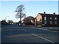
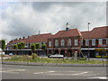
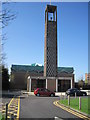
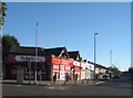
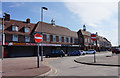
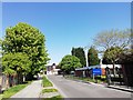
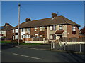
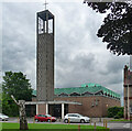
Knotty Ash & Dovecot Park Ward represents a specific slice of Liverpool, established in 2023 following a significant boundary review that streamlined the city's ward structure. You are looking at a compact ward covering just 1.1 km², centred on the Knotty Ash district in North West England. This area sits at coordinates approximately 53.4167° N, 2.8800° W, placing it firmly within the Liverpool City Council jurisdiction. The land itself holds a history stretching back to 1870-72, when Knotty Ash served as a chapelry in Walton-on-the-Hill parish with a population of roughly 1,800 people. Your daily life here will be influenced by this dense footprint and its historical evolution. In 1918, the locality hosted camps for returning American soldiers before housing 488 families until 1933. These historical layers define the current residential character of the ward. The area combines the practicalities of modern urban living with a tangible sense of place derived from its past. Residents navigate a neighbourhood that has evolved from a rural chapelry to a defined electoral ward. Living in Knotty Ash & Dovecot Park Ward means dealing with a space where historical milestones, such as the establishment of national schools, still resonate in the community fabric. The ward's creation in 2023 merged the former Knotty Ash ward with parts of Dovecot to form this current administrative unit. This ward is not merely a statistical point on a map but a living statement of Liverpool's administrative reshaping. The boundaries define the limits of local services and community engagement. You find yourself in an area where the past informs the present, with the legacy of the 1800s coexisting with the ward boundaries set over a century later. The coordinate location ensures precise identification for official purposes, while the historical context provides depth to the daily experience.
- Area Type
- District Borough Unitary Ward
- Area Size
- 1.1 km²
- Population
- Not available
- Population Density
- Not available
Demographics
The community within Knotty Ash & Dovecot Park Ward reflects a distinctly older population profile. The median age stands at 70, marking this as an area with a significant elderly demographic. You will find that the total age range dominates the statistics, indicating a broad distribution rather than a single-age concentration. This age profile shapes the local culture and influences the demand for amenities such as healthcare and leisure facilities suitable for older residents. Home ownership presents a clear divide in this community. Exactly 45% of households own their homes, meaning just under half of the population holds the title to their property. The remaining 55% rely on rental accommodation, suggesting a substantial tenant population residing within these boundaries. This split indicates a mixed market where you must consider both purchase and rent options when looking for homes in Knotty Ash & Dovecot Park Ward. Regarding household composition and accommodation types, the available data covers only the total figures without breaking them down by specific category. Similarly, information on the predominant ethnic group and religious affiliation exists in the dataset but is not detailed here. Despite these generalised categories, the demographic snapshot is clear. The high median age drives the character of the ward. When assessing living in Knotty Ash & Dovecot Park Ward, you are dealing with an area where every second home is rented. The total household count drives the service demands across this 1.1 km² zone.
Household Size
Accommodation Type
Tenure
Ethnic Group
Religion
Household Composition
Age
Household Deprivation
NS-SEC
Explore more demographic insights in this area
Go to Demographics tabPlanning
Planning Constraints
- Flood RiskPremium
- Ramsar Wetland SitesPremium
- Area of Outstanding Natural BeautyPremium
- Protected Nature ReservePremium
- Protected WoodlandPremium