Area Overview for Kilnhouse Ward
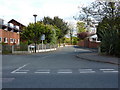
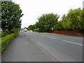
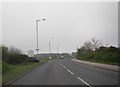
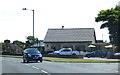
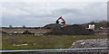
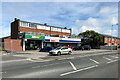
Photos of Kilnhouse Ward


Area Information
Living in Kilnhouse Ward offers a settled environment on a district defined by its distinct demographics. The area covers a total landmass of 4.7 km², creating a compact community where residents interact closely. You will find that life here moves at a pace dictated by a population with a median age of 70. This figure indicates a neighbourhood heavily weighted towards older demographics, shaping the local rhythm and services. Homes in Kilnhouse Ward reflect this reality, catering to those seeking a retirement-focused living arrangement rather than a family hub. The ward functions as a self-contained district borough unitary ward within England, meaning local governance is streamlined for the residents you will meet. Daily life revolves around proximity and stability. There is no large influx of young commuters or transient professionals here. Instead, the atmosphere remains consistent year-round. When you consider buying a home in Kilnhouse Ward, you are entering a space defined by its senior population. This density of older residents informs the types of amenities that exist and the general social tone. The ward does not sprawl outward like larger urban zones. Its confined size ensures that you can navigate the area without travelling far. You will experience a quiet existence where neighbours likely reside as long-term occupants. This stability provides a predictable backdrop for every decision you make regarding your future residence.
- Area Type
- District Borough Unitary Ward
- Area Size
- 4.7 km²
- Population
- Not available
- Population Density
- Not available
Demographics
The community in Kilnhouse Ward is clearly defined by its age profile and ownership patterns. You will find that the average resident is 70 years old, making this the median age for the entire ward. This statistic confirms that Kilnhouse Ward is a retirement area where daily life caters to an older demographic. Most household compositions reflect this stability, although specific breakdowns for single-person versus couple homes are not detailed in current records. What you do know is that 73% of homes in Kilnhouse Ward are owner-occupied. This high rate signals a deeply rooted community where long-term residency is the norm. You are unlikely to find a transient population living in rentals here. Instead, the majority of people have established permanent roots in their specific streets. The accommodation types within the ward mirror this settled nature, featuring a stock designed for older needs. Diversity metrics, such as predominant ethnic groups and religious affiliations, are present in the data but lack specific breakdown figures. This absence of granular diversity data suggests a relatively homogeneous community. You do not need to guess the nature of the neighbourhood look; the age skew is undeniable. Living in Kilnhouse Ward means joining a group of peers rather than mixing with varied age brackets. The social fabric is tight and traditional. When you walk through the streets, you see neighbours who have lived there for decades. This longevity creates a supportive but static environment. The 73% ownership rate further cements this image of a place built for permanence rather than temporary living arrangements.
Household Size
Accommodation Type
Tenure
Ethnic Group
Religion
Household Composition
Age
Household Deprivation
NS-SEC
Explore more demographic insights in this area
Go to Demographics tabPlanning
Planning Constraints
- Flood RiskPremium
- Ramsar Wetland SitesPremium
- Area of Outstanding Natural BeautyPremium
- Protected Nature ReservePremium
- Protected WoodlandPremium