Area Overview for Kendal Castle Ward
Photos of Kendal Castle Ward

Area Information
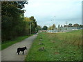
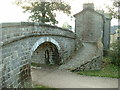
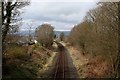
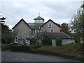
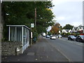
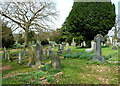
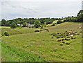
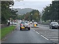
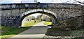
Living in Kendal Castle Ward means residing within a compact 2.0 km² district that anchors the historic Barony of Kendal in Cumbria. This electoral ward sits at approximately 54.317°N, 2.731°W, centred on the town itself. The area forms part of a unitary authority established after recent boundary changes, blending medieval heritage with modern administration. You will find the Castle ruins perched on a hill, marking the eastern boundary of the conservation area and overlooking the town. Historically, Kirkby Kendal featured governance by mayor and aldermen, a tradition that echoes in its status as a centuries-old settlement. The ward includes Kendal parish and twenty townships, creating a densely populated yet historically significant neighbourhood. Daily life here is defined by proximity to local landmarks such as the medieval Hospital of St Leonard and former deer parks. For those considering homes in Kendal Castle Ward, the location offers immediate access to the town's core while retaining distinct historical character. The area remains a key part of the administrative structure for Westmorland and Furness Council, ensuring your address connects directly to established governance frameworks. You live in a place where the past and present intersect constantly, from the visible landscape features to the administrative identity of the unitary ward.
- Area Type
- District Borough Unitary Ward
- Area Size
- 2.0 km²
- Population
- Not available
- Population Density
- Not available
Demographics
The community in Kendal Castle Ward displays very specific demographic characteristics that define daily life for residents. The median age stands at 70 years, indicating a population dominated by older adults and retirees. This age profile suggests a neighbourhood where silence and established routines prevail, rather than the energy typically associated with younger families. Home ownership is exceptionally high at 83%, meaning the vast majority of people buying homes in Kendal Castle Ward are securing property for themselves or their partners rather than renting. This statistic points to a stable community where residents have likely lived in their properties for many years. You will find minimal transient population, as few households are tenanted properties. The ward contains no specific data regarding ethnic groups or religious breakdown, but the extreme age skew dominates the social fabric. Most common age ranges align with the total population, reinforcing the retirement-focused nature of the ward. Deprivation levels are not explicitly scored in the available figures, but the high ownership rate often correlates with lower financial instability compared to rental-heavy areas. If you are looking for a quiet retirement setting or a place to stay for the long term, the demographics confirm this is an enclave of established permanence. The average resident likely neighbours other pensioners, creating a mutual sense of shared history and low turnover.
Household Size
Accommodation Type
Tenure
Ethnic Group
Religion
Household Composition
Age
Household Deprivation
NS-SEC
Explore more demographic insights in this area
Go to Demographics tabPlanning
Planning Constraints
- Flood RiskPremium
- Ramsar Wetland SitesPremium
- Area of Outstanding Natural BeautyPremium
- Protected Nature ReservePremium
- Protected WoodlandPremium
- Crime RiskPremium