Area Overview for Jubilee Ward
Photos of Jubilee Ward
Area Information
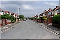
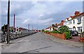
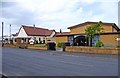
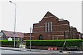
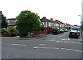
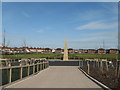
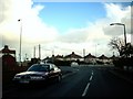
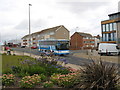
Jubilee Ward stands as a distinct district within the borough, covering a compact footprint of just 2.0 square kilometres. This small unitary ward accommodates a resident population of 1,384 people, resulting in a population density of 686 people per square kilometre. Such density suggests a community that is close-knit without the sprawling nature often found in larger districts. The area attracts specific types of residents, likely drawn by its integration into the broader local infrastructure and proximity to essential services. Living in Jubilee Ward means navigating a space where every neighbour is potentially just a short walk away. The ward is not merely a statistical division but a defined sphere of everyday life for its inhabitants. Prospective buyers should appreciate how this size influences local governance and community engagement. The region does not hide behind abstract planning terms but presents a tangible living environment. You will find that daily routines here are shaped by this concentrated geography. The ward represents a specific slice of the borough's character, offering a residential experience defined by its boundaries and population limits. Understanding these dimensions gives you a clear picture of what daily life entails in this specific locality.
- Area Type
- District Borough Unitary Ward
- Area Size
- 2.0 km²
- Population
- 1384
- Population Density
- 686 people/km²
Demographics
The community profile of Jubilee Ward reveals an older demographic, as evidenced by a median age of 70 years. This statistic indicates that the area is populated primarily by retirees or long-term residents rather than young families or students. Household composition and accommodation type data confirm this trend, painting a picture of a stable, settled population. Sixty-two per cent of residents own their homes, a figure that far exceeds typical rental-dominated urban zones. This high rate of home ownership suggests a community invested in its immediate surroundings and less likely to move frequently. The dominance of owner-occupiers often correlates with specific neighbourhood values, such as quiet streets and established routines. While the data indicates that overall household composition figures show the total breakdown, the skewed age profile is the most defining feature. You should expect a quieter environment where neighbours have known each other for decades. This demographic reality influences local demand for amenities, favouring healthcare access and leisure spaces suitable for older adults over bustling nightlife or primary school hubs. The diversity within the ward remains the Total as per the dataset, and religion figures similarly reflect the total population without specifying a dominant faith group.
Household Size
Accommodation Type
Tenure
Ethnic Group
Religion
Household Composition
Age
Household Deprivation
NS-SEC
Explore more demographic insights in this area
Go to Demographics tabPlanning
Planning Constraints
- Flood RiskPremium
- Ramsar Wetland SitesPremium
- Area of Outstanding Natural BeautyPremium
- Protected Nature ReservePremium
- Protected WoodlandPremium
- Crime RiskPremium