Area Overview for Irthington
Photos of Irthington
Area Information
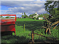
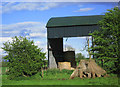
Irthington is a civil parish situated in the North East of England, covering a substantial area of 29.9 square kilometres. This sizeable footprint allows for a spread-out environment that defines the daily rhythm of life for its residents. You will find that living in Irthington often means navigating a landscape where properties are not densely clustered, offering a distinct pace compared to more urbanised neighbourhoods. The parish is not defined by high-rise blocks or city centres, but rather by its status as a distinct local administrative unit within the wider county. The character of this area is shaped by its geography and function as a recognised community. When you look beyond the administrative boundary, the physical space is significant enough to support a variety of residential settings while maintaining a sense of locality. The area's identity is rooted in its long-standing existence as a parish, a historical continuity that influences how people interact with their surroundings. There are no sprawling industrial zones mentioned in the core description, suggesting a residential or rural focus. This context helps you understand what to expect when considering homes in Irthington: a defined territory with clear boundaries rather than an endless expanse of development.
- Area Type
- Parish
- Area Size
- 29.9 km²
- Population
- Not available
- Population Density
- Not available
Demographics
The community within Irthington is defined by a pronounced age profile, with a median age of 70 years old. This statistic indicates that you will encounter a population predominantly comprised of older adults rather than young families or working-age professionals on average. The demographic data shows that the total age range is the most common category when aggregating all residents, which reinforces the picture of an older settlement. Living in Irthington means engaging with a neighbourhood where the social fabric is likely centred around retirement and established families. Home ownership stands at 85% of households, a figure that underscores a very settled community. Such a high percentage suggests you will find mostly people who have put down roots and own their flats or houses outright. This level of tenure implies lower transient rates and a stable electorate. While the data does not specify the breakdown of flats versus houses or details on household composition percentages, the ownership rate alone provides a strong indicator of stability. There is no data detailing predominant ethnic groups or religious affiliations, so you cannot make assumptions about diversity or specific faith communities. Instead, the demographic picture is one of senior home ownership, creating a neighbourhood environment tailored to older residents.
Household Size
Accommodation Type
Tenure
Ethnic Group
Religion
Household Composition
Age
Household Deprivation
NS-SEC
Explore more demographic insights in this area
Go to Demographics tabPlanning
Planning Constraints
- Flood RiskPremium
- Ramsar Wetland SitesPremium
- Area of Outstanding Natural BeautyPremium
- Protected Nature ReservePremium
- Protected WoodlandPremium