Area Overview for Ingol & Cottam Ward
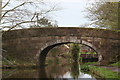
Photos of Ingol & Cottam Ward
Area Information
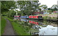
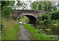
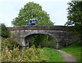
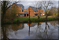
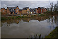
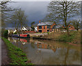
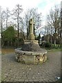
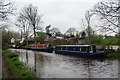
Ingol & Cottam Ward is an electoral ward of Preston City Council in Lancashire, North West England. This district encompasses the suburbs of Ingol and Cottam, along with the area of Tanterton. The ward lies approximately three miles west of the city centre. Its boundaries touch Greyfriars, Cadley, Ashton, Larches, Lea, and Preston Rural North. Together with the Ward of Tanterton, it hosts a population of 7,369 people based on the 2011 census. The total land area covers 6.2 km². The suburb has evolved significantly. Before the 1960s, it was a quiet rural fringe defined by the Lancaster Canal running through the south. Extensive council housing development began in the Barry Avenue estate and east of Tag Lane. Private housing emerged in the 1970s and 1980s, including the Ingol Golf Village, followed by social housing in Tanterton. Further infilling occurred into the 1990s. Today, the area features a mix of new builds and established estates. The civil parish of Ingol and Tanterton was created in 2012, reflecting the area's growth from a rural backwater into a distinct suburban community. You can find a library, community centre, and places of worship such as St Margaret's CofE and Holy Family RC within the ward limits.
- Area Type
- District Borough Unitary Ward
- Area Size
- 6.2 km²
- Population
- Not available
- Population Density
- Not available
Demographics
The community centre of Ingol & Cottam Ward reflects a mature population profile. The median age of residents is 70 years, which is significantly higher than the national average. This age structure suggests the ward contains many empty nesters and older retirees. Home ownership is prevalent in the area, with 59% of residents owning their properties outright or with a mortgage. Despite this high ownership rate, there are notable proportions of specific household types. A substantial 37% of households pay social rent, while single-person households make up 39% of the total. These figures indicate a diverse living situation where older individuals and empty nesters often live alone. Accommodation types vary across the 6.2 km². You will find a higher proportion of flats than the averages for Preston or the North West, standing at 27.4%. Semi-detached housing also features prominently, accounting for 28.9% of the stock. Employment patterns differ from the wider council area. Personal service roles make up 14% of local employment, which is higher than the 9% figure for Preston. This aligns with the presence of schools and local services. The demographic picture shows a settled community with a strong property base but also significant tenancy for specific groups.
Household Size
Accommodation Type
Tenure
Ethnic Group
Religion
Household Composition
Age
Household Deprivation
NS-SEC
Explore more demographic insights in this area
Go to Demographics tabPlanning
Planning Constraints
- Flood RiskPremium
- Ramsar Wetland SitesPremium
- Area of Outstanding Natural BeautyPremium
- Protected Nature ReservePremium
- Protected WoodlandPremium
- Crime RiskPremium