Area Overview for Hulton Ward
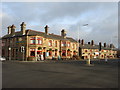
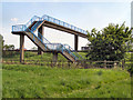
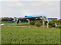
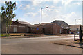
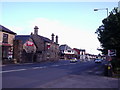
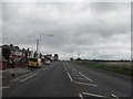
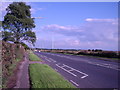
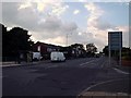
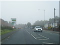
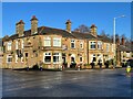
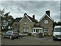
Photos of Hulton Ward

Area Information
Hulton Ward sits approximately 5km south-west of Bolton town centre, forming a distinct suburb within the Westhoughton area. This electoral ward lies within the unitary authority of Bolton Metropolitan Borough Council in Greater Manchester. You are looking at a community spread across 10.5 square kilometres with a total population of 3,442. The region encompasses historical townships including Over Hulton, Middle Hulton, and Little Hulton. These areas once formed part of the historic county of Lancashire before merging into Bolton and Westhoughton in 1898. The landscape retains memories of the Hulton family, who owned the chief manor at Hulton Park in Over Hulton for over 800 years. Although Hulton Hall was demolished in 1958, the 325-acre estate remains a notable local feature. Living here means existing in a place with deep roots stretching back to at least 1235. The term Hulton first appeared in records in 1235 as Helghtun. Residents navigate a suburban environment that was historically significant enough to host events like the Peterloo Massacre in 1819. The ward includes the area around postcode BL3 3QB, acting as a residential extension to the wider Bolton metropolitan area. You are entering a zone where history intersects with modern suburb living. The geography defines a quiet stretch of land that has evolved from a historic manorial seat into a contemporary residential ward. You are entering a mature community with a median age of 70 years. This figure indicates an older population profile compared to many other regions. The demographic data shows that the majority of people in this ward fall into an older age bracket. This age distribution suggests a neighbourhood that has evolved beyond its working-age peak. Home ownership stands at 66%, which is a significant proportion of the total housing. This statistic implies that most households have a stake in the property market rather than renting. The community consists of long-term residents who have likely lived in their properties for decades. There is a clear shift away from transient rental populations toward settled owner-occupiers. The population density is 327 people per square kilometre. This density level reflects a moderately populated urban ward without being overly crowded. The statistics you see paint a picture of stability. The high home ownership rate means you will encounter established residents in the streets. The age profile means public services and local amenities cater to an older demographic. You are looking at a community where the people are settled and the housing stock is mostly owned. The housing landscape in Hulton Ward is defined by a 66% home ownership rate. This means you will find predominantly owner-occupied properties rather than a rental market. More than two-thirds of households own their homes outright or with a mortgage. This high level of ownership suggests a stable housing stock with long-term residents. The remaining 34% of households are likely renting from private landlords or social housing providers. You should expect to find a mix of older houses and terrace properties due to the historic nature of the townships. The area encompasses Over Hulton, Middle Hulton, and Little Hulton, which historically contributed to the housing mix. The property market here serves owners who value stability and community ties. When you search for homes in Hulton Ward, the inventory will reflect this high ownership baseline. There are no large developments of modern rental apartments dominating the skyline. Instead, the accommodation type total indicates a traditional fabric of housing owned by families or individuals. This market dynamic means sellers may hold onto properties longer, potentially affecting turnover rates. Buyers must approach with the expectation of interacting with owners who are deeply embedded in the area. The 66% figure is the key indicator for anyone assessing the commercial nature of the local real estate. Digital connectivity in Hulton Ward is excellent. The fixed broadband quality score reaches 96 out of 100, placing this ward among the top performers for internet infrastructure. This high score means you can rely on fast, stable internet for working from home or streaming entertainment. You do not need to worry about weak signals or slow upload speeds. The digital landscape supports heavy usage without interruption. For residents dealing with legacy age demographics, this connectivity offers a significant advantage for remote communication or telehealth services. The area does not suffer from the digital exclusion often seen in older estates. You have robust fixed-line access that meets the demanding needs of modern users. The location near postcode BL3 3QB benefits from this advanced infrastructure. Even if the physical roads were narrow, the digital motorway running through the ward is wide and fast. This level of service ensures that living in Hulton Ward keeps you connected to the wider world. The region handles large data transfers efficiently. You can expect high-speed performance regardless of your internet provider. The 96 score indicates a fully developed network suitable for any household requirement. You must address two critical factors regarding safety and environmental planning in this ward. The crime risk profile presents a serious concern with a score of 0 out of 100 and a critical level. This finding indicates that crime rates in Hulton Ward are above the national average. A safety score of 0 signals a high risk environment where enhanced security measures are necessary. You should expect to invest in stronger home security systems. Police advice for this area would emphasise vigilance and fortified defences. This stands in contrast to other environmental assessments which pass successfully. The ward has a score of 0 for flood risk, meaning there is low flood risk coverage. No parts of this 10.5 square kilometre area are prone to flooding. This is a positive factor for anyone fearing water damage or insurance premiums related to flood zones. The ward also passes for Ramsar wetland sites, Areas of Outstanding Natural Beauty, and protected nature reserves, all scoring 0 for risk. However, there is a warning on protected woodland with a score of 1.06. The area contains protected woodland that cannot be easily developed. This constraint affects planning permissions but does not threaten your immediate safety. The primary hazard remains human activity rather than natural disasters. You must prioritise security measures against crime while enjoying the safety of a dry and stable physical environment. What is the home ownership situation in Hulton Ward?Home ownership in Hulton Ward stands at 66% of the total population. This high percentage indicates a predominantly owner-occupied area with stable residents rather than a rental market. Most households own their properties, reflecting the long history of estates like Hulton Park. Is the population mainly young families or older residents?The median age in Hulton Ward is 70 years. This figure shows that the community is dominated by an older demographic. The population density is 327 people per square kilometre, spread across the historic townships of Over, Middle, and Little Hulton. How is the internet connection in Hulton Ward?Digital connectivity is excellent in Hulton Ward with a fixed broadband score of 96 out of 100. You can expect high-speed, reliable internet suitable for working from home or streaming. This top-tier performance ensures you stay connected efficiently within the ward. Are there safety concerns for buyers in Hulton Ward?Yes, crime risk is critical in Hulton Ward with a score of 0 out of 100. This means crime rates are above average and you should implement enhanced security measures. Flood risk is low with a score of 0, and there is no protected woodland impact beyond planning constraints.
- Area Type
- District Borough Unitary Ward
- Area Size
- 10.5 km²
- Population
- 3442
- Population Density
- 327 people/km²
Demographics
You are entering a mature community with a median age of 70 years. This figure indicates an older population profile compared to many other regions. The demographic data shows that the majority of people in this ward fall into an older age bracket. This age distribution suggests a neighbourhood that has evolved beyond its working-age peak. Home ownership stands at 66%, which is a significant proportion of the total housing. This statistic implies that most households have a stake in the property market rather than renting. The community consists of long-term residents who have likely lived in their properties for decades. There is a clear shift away from transient rental populations toward settled owner-occupiers. The population density is 327 people per square kilometre. This density level reflects a moderately populated urban ward without being overly crowded. The statistics you see paint a picture of stability. The high home ownership rate means you will encounter established residents in the streets. The age profile means public services and local amenities cater to an older demographic. You are looking at a community where the people are settled and the housing stock is mostly owned. The housing landscape in Hulton Ward is defined by a 66% home ownership rate. This means you will find predominantly owner-occupied properties rather than a rental market. More than two-thirds of households own their homes outright or with a mortgage. This high level of ownership suggests a stable housing stock with long-term residents. The remaining 34% of households are likely renting from private landlords or social housing providers. You should expect to find a mix of older houses and terrace properties due to the historic nature of the townships. The area encompasses Over Hulton, Middle Hulton, and Little Hulton, which historically contributed to the housing mix. The property market here serves owners who value stability and community ties. When you search for homes in Hulton Ward, the inventory will reflect this high ownership baseline. There are no large developments of modern rental apartments dominating the skyline. Instead, the accommodation type total indicates a traditional fabric of housing owned by families or individuals. This market dynamic means sellers may hold onto properties longer, potentially affecting turnover rates. Buyers must approach with the expectation of interacting with owners who are deeply embedded in the area. The 66% figure is the key indicator for anyone assessing the commercial nature of the local real estate. Digital connectivity in Hulton Ward is excellent. The fixed broadband quality score reaches 96 out of 100, placing this ward among the top performers for internet infrastructure. This high score means you can rely on fast, stable internet for working from home or streaming entertainment. You do not need to worry about weak signals or slow upload speeds. The digital landscape supports heavy usage without interruption. For residents dealing with legacy age demographics, this connectivity offers a significant advantage for remote communication or telehealth services. The area does not suffer from the digital exclusion often seen in older estates. You have robust fixed-line access that meets the demanding needs of modern users. The location near postcode BL3 3QB benefits from this advanced infrastructure. Even if the physical roads were narrow, the digital motorway running through the ward is wide and fast. This level of service ensures that living in Hulton Ward keeps you connected to the wider world. The region handles large data transfers efficiently. You can expect high-speed performance regardless of your internet provider. The 96 score indicates a fully developed network suitable for any household requirement. You must address two critical factors regarding safety and environmental planning in this ward. The crime risk profile presents a serious concern with a score of 0 out of 100 and a critical level. This finding indicates that crime rates in Hulton Ward are above the national average. A safety score of 0 signals a high risk environment where enhanced security measures are necessary. You should expect to invest in stronger home security systems. Police advice for this area would emphasise vigilance and fortified defences. This stands in contrast to other environmental assessments which pass successfully. The ward has a score of 0 for flood risk, meaning there is low flood risk coverage. No parts of this 10.5 square kilometre area are prone to flooding. This is a positive factor for anyone fearing water damage or insurance premiums related to flood zones. The ward also passes for Ramsar wetland sites, Areas of Outstanding Natural Beauty, and protected nature reserves, all scoring 0 for risk. However, there is a warning on protected woodland with a score of 1.06. The area contains protected woodland that cannot be easily developed. This constraint affects planning permissions but does not threaten your immediate safety. The primary hazard remains human activity rather than natural disasters. You must prioritise security measures against crime while enjoying the safety of a dry and stable physical environment. What is the home ownership situation in Hulton Ward?Home ownership in Hulton Ward stands at 66% of the total population. This high percentage indicates a predominantly owner-occupied area with stable residents rather than a rental market. Most households own their properties, reflecting the long history of estates like Hulton Park. Is the population mainly young families or older residents?The median age in Hulton Ward is 70 years. This figure shows that the community is dominated by an older demographic. The population density is 327 people per square kilometre, spread across the historic townships of Over, Middle, and Little Hulton. How is the internet connection in Hulton Ward?Digital connectivity is excellent in Hulton Ward with a fixed broadband score of 96 out of 100. You can expect high-speed, reliable internet suitable for working from home or streaming. This top-tier performance ensures you stay connected efficiently within the ward. Are there safety concerns for buyers in Hulton Ward?Yes, crime risk is critical in Hulton Ward with a score of 0 out of 100. This means crime rates are above average and you should implement enhanced security measures. Flood risk is low with a score of 0, and there is no protected woodland impact beyond planning constraints.
Household Size
Accommodation Type
Tenure
Ethnic Group
Religion
Household Composition
Age
Household Deprivation
NS-SEC
Explore more demographic insights in this area
Go to Demographics tabPlanning
Planning Constraints
- Flood RiskPremium
- Ramsar Wetland SitesPremium
- Area of Outstanding Natural BeautyPremium
- Protected Nature ReservePremium
- Protected WoodlandPremium
- Crime RiskPremium