Area Overview for Horwich
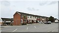
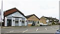
Photos of Horwich


Area Information
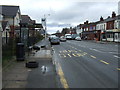
Horwich covers an area of 6.5 km² and sits within the broader built-up zone of Chorley. Microscopically viewed as a compact town, it houses 4,228 residents across that small footprint. This density results in a population figure of 652 people per km², creating a community that feels intimate yet connected to the wider North West infrastructure. Living in Horwich means navigating a neighbourhood where proximity is key. The layout supports easy access to rail networks and retail hubs without the sprawl typical of larger conurbations. Your daily commute likely passes through Horwich Parkway, which anchors the eastern edge of the town and links directly to Manchester and Preston. Families and retirees form the core of this community, drawn by the balance of quiet residential streets and accessible amenities. The area functions as a practical base for those working across Lancashire or connecting with Greater Manchester for employment. Homes in Horwich offer a settled lifestyle where the scale of the town allows for straightforward navigation. Whether you are familiarising yourself with the streets or planning a move, the compact nature ensures everything from shops to stations lies within a short journey. This built-up status classifies the location as a distinct residential unit rather than a diffuse rural setting, providing a defined boundary for your home search.
- Area Type
- Built Up Area 250
- Area Size
- 6.5 km²
- Population
- 4228
- Population Density
- 652 people/km²
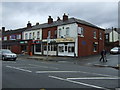
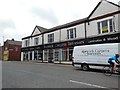
Your daily routine in Horwich benefits from a compact layout that brings essential amenities within easy reach. Five retail outlets operate within practical walking distance, ensuring you can complete shopping errands without extensive travel. The retail landscape is anchored by Co-op Chorley, Iceland Horwich, and M&S Middlebrook, providing comprehensive grocer and department store options. These notable stores mean you do not need to venture far to stock your home with fresh produce or household goods. Beyond standard retail, five railway stations provide immediate access to wider regional travel. Horwich Parkway Railway Station, Blackrod Railway Station, and Lostock Railway Station integrate transport and lifestyle seamlessly. The proximity of rail hubs allows you to combine a morning coffee with a train ticket effortlessly. This density of amenities creates a self-sufficient environment where most needs are met locally. You will find that your weekly shop takes only minutes rather than hours. The availability of major chains like Iceland and M&S brings national standards to this localised town. Shopping at Co-op Chorley offers a familiar touch for residents who value traditional high-street interaction. This blend of retail and transport nodes defines the character of living in Horwich, ensuring convenience never feels like a luxury.
Amenities
Schools
Families considering schools near Horwich have access to several primary options within the immediate vicinity. Chorley New Road Primary School serves as a key local institution, providing early education for children in the catchment. Just across the street, Beacon Primary School offers a second primary choice for immediate neighbourhood families. Claypool Primary School holds a good Ofsted rating, marking it as a standout performer for those prioritising academic performance. St Catherine's CofE Primary School, Horwich provides faith-based education within the town limits. Furthermore, Horwich Parish CofE Primary School also carries a good Ofsted rating, reinforcing the quality of religious education provision. The presence of four named primary schools indicates a dense concentration of educational facilities for early years. This mix includes both community schools and Church of England institutions, catering to diverse family values. While secondary education data is not provided in the local records, the abundance of primary schools suggests a well-supported foundation for young learners. You can expect shorter travel times to school compared to outlying rural villages. The existence of two schools with good ratings gives parents specific options aligned with high standards. This level of provision means you do not need to travel significant distances to access a standard primary education. The cluster of schools in Horwich supports the local demographic need for early schooling.
| Rank | School | Type | Entry gender | Ages |
|---|
Explore more schools in this area
Go to Schools tabDemographics
The community in Horwich reflects a settled population with a median age of 71 years. This figure indicates a neighbourhood where long-term residents dominate the census returns. While the most common age range data aggregates the total population, the high median suggests few young households drive the demographics. Home ownership stands at 71%, a statistic that paints a picture of stability and established tenancies rather than a transient rental market. This majority of owner-occupiers implies that much of the local housing stock has been owned rather than rented over recent decades. The accommodation type breakdown covers the total inventory, meaning you will find a mix of property ages and styles consistent with a historic built-up area. Diversity metrics cover the total demographic spread, though specific ethnic or religious groups are not detailed in the available records. However, the age profile and ownership rate suggest a traditional community structure. For those considering living in Horwich, the high ownership percentage often correlates with stronger community ties and lower turnover rates. You can expect neighbours who have lived there for significant periods, shaping a predictable and calm local environment. The lack of a young median age also means fewer teenage demand spikes in local services, resulting in quieter public spaces.
Household Size
Accommodation Type
Tenure
Ethnic Group
Religion
Household Composition
Age
Household Deprivation
NS-SEC
Explore more demographic insights in this area
Go to Demographics tabPlanning
Planning Constraints
- Crime RiskPremium