Area Overview for Hopwood Hall Ward
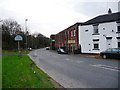
Photos of Hopwood Hall Ward
Area Information
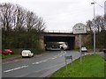
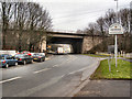
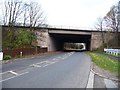
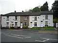
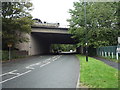
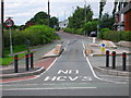
Living in Hopwood Hall Ward offers a distinctive experience within the Metropolitan Borough of Rochdale, situated in the North West of England. This electoral ward covers 7.7 square kilometres and houses 2,864 residents. The area takes its name from a historic Grade II* listed manor house, a landmark that sits approximately one mile north of Middleton town centre and six miles from Manchester city centre. Daily life here reflects a connection to local heritage, with the former estate grounds now partly occupied by Hopwood Hall College. The neighbourhood is defined by its proximity to Middleton and its position relative to the wider city. Prospective buyers should note the specific geography, which includes the original estate grounds. The character of the ward stems from its deep historical roots, distinguishing it from other residential zones in the district. You are entering a community where the past still physically shapes the landscape. The location provides a defined scope for living, balancing local amenities in Middleton with accessibility to the urban centre nearby. Understanding the ward limits is crucial for anyone considering homes in this specific boundary.
- Area Type
- District Borough Unitary Ward
- Area Size
- 7.7 km²
- Population
- 2864
- Population Density
- 373 people/km²
Demographics
The community in Hopwood Hall Ward presents a clear demographic profile focused on an older population. The median age stands at exactly 70 years, indicating a significant shift away from a younger working-age cohort. Most residents fall into these older age brackets, which shapes the social fabric and service needs of the area. Home ownership is strong, with 64% of households owning their property outright or through a mortgage. This high level of ownership suggests long-term stability within the ward. Household composition reflects this older demographic, with families likely smaller or empty compared to younger areas. The accommodation types available are defined by this ownership pattern, favouring houses suited to retirement or older couples rather than high-density rental blocks. Ethnic diversity and religious composition are noted in the broader data records, though specific breakdowns are aggregated in the total figures provided. Residents here live in a setting designed for stability rather than rapid turnover. Deprivation levels are not explicitly quantified in the current dataset, meaning you cannot measure economic disadvantage directly. However, the age structure implies specific local challenges regarding access to employment or youth services. The high home ownership rate of 64% often correlates with established neighbourhoods where residents have stayed for decades. This stability creates a quiet, settled atmosphere, though it may lack the vibrancy of areas with younger, transient populations.
Household Size
Accommodation Type
Tenure
Ethnic Group
Religion
Household Composition
Age
Household Deprivation
NS-SEC
Explore more demographic insights in this area
Go to Demographics tabPlanning
Planning Constraints
- Flood RiskPremium
- Ramsar Wetland SitesPremium
- Area of Outstanding Natural BeautyPremium
- Protected Nature ReservePremium
- Protected WoodlandPremium
- Crime RiskPremium