Area Overview for Holyrood Ward
Photos of Holyrood Ward

Area Information
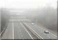
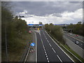
Holyrood Ward is a small district within the Metropolitan Borough of Bury, covering an area of just 4.5 square kilometres. The location sits near Prestwich in Greater Manchester, forming part of the Bury South parliamentary constituency. This ward had a population of 2,974 residents as of the latest census, creating a tightly knit community with a density of 667 people per square kilometre. The boundaries for this electoral ward remained stable following the 2018 review, providing a consistent geographic identity for those residing in the local area. Life in Holyrood Ward is defined by its proximity to established neighbourhoods while maintaining its own distinct ward status. You are living in a space that balances urban accessibility with managed population levels, resulting in a residential zone where 73% of households own their property outright or with a mortgage. The area functions as a settled part of Greater Manchester where daily life revolves around the established infrastructure of the surrounding borough.
- Area Type
- District Borough Unitary Ward
- Area Size
- 4.5 km²
- Population
- 2974
- Population Density
- 667 people/km²
Demographics
The community profile of Holyrood Ward is heavily skewed towards older residents, with a median age of 70 years. This demographic structure indicates a population dominated by seniors rather than families with young children or working-age adults seeking a dynamic youth culture. High home ownership levels stand at 73%, reflecting a settled community where residents have established long-term ties to their specific properties. Most households consist of individuals or widowed/retired couples, aligning with the advanced median age of the population. While specific data regarding accommodation types, predominant ethnic groups, and religious affiliation is not available in the current records, the age distribution clearly shapes the social fabric of the ward. Living in Holyrood Ward means engaging with a mature demographic where decision-making often prioritises stability and established routines over rapid change. You should expect a quiet atmosphere where neighbours have likely known one another for decades. This age profile influences local services and community engagement, creating an environment tailored to the needs of retirees rather than the typical young professional or growing family.
Household Size
Accommodation Type
Tenure
Ethnic Group
Religion
Household Composition
Age
Household Deprivation
NS-SEC
Explore more demographic insights in this area
Go to Demographics tabPlanning
Planning Constraints
- Flood RiskPremium
- Ramsar Wetland SitesPremium
- Area of Outstanding Natural BeautyPremium
- Protected Nature ReservePremium
- Protected WoodlandPremium
- Crime RiskPremium