Area Overview for Hollinfare
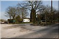
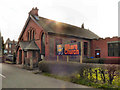
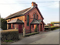
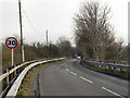
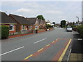
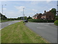
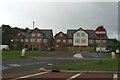
Photos of Hollinfare


Area Information
Hollinfare is a compact built-up area in England, covering 27.3 hectares. Its population is predominantly older, with a median age of 70, suggesting a community with long-term residents and a stable demographic. The area is well-served by transport links, including five railway stations such as Glazebrook and Irlam, and five metro stops like Timperley and Brooklands. Nearby, City Airport Manchester offers regional connectivity. For daily life, residents have access to retail hubs like Tesco Central and Co-op Heatley, as well as local amenities. The high home ownership rate of 84% indicates a settled community, with properties likely to be family homes or long-term investments. While the area lacks detailed data on household types or diversity, its infrastructure and services suggest a practical, commuter-friendly environment. Living in Hollinfare means balancing proximity to urban amenities with a quieter, established residential character.
- Area Type
- Built Up Area 250
- Area Size
- 27.3 hectares
- Population
- Not available
- Population Density
- Not available
Hollinfare’s lifestyle is shaped by its proximity to retail and transport hubs. Nearby, residents can access shops like Tesco Central, Heron Partington, and Co-op Heatley, offering everyday essentials. The railway stations and metro stops, such as Birchwood and Sale, provide easy access to urban centres, while City Airport Manchester adds regional travel options. Though the area lacks detailed data on parks or leisure facilities, the presence of multiple transport links and retail venues suggests a practical, commuter-focused lifestyle. The mix of shops and transport infrastructure supports a convenient daily routine, with minimal need for long-distance travel. For those valuing accessibility over sprawling amenities, Hollinfare offers a streamlined approach to living.
Amenities
Schools
Hollinfare is served by two primary schools: Hollins Green St Helen’s CofE (Aided) Primary School and St Helen’s Church of England Primary School. Both are Church of England-affiliated, offering faith-based education within the state sector. The presence of two primary schools suggests a focus on local education, though the data does not provide Ofsted ratings or academic performance metrics. Families may find these schools suitable for younger children, though the lack of secondary schools nearby means students may need to travel for further education. The mix of school types reflects the area’s religious and community character, but prospective buyers should verify current admissions policies and transportation options for older children.
| Rank | A + A* % | School | Type | Entry gender | Ages |
|---|---|---|---|---|---|
| 1 | N/A | Hollins Green St Helen's CofE (Aided) Primary School | primary | N/A | N/A |
| 2 | N/A | St Helen's Church of England Primary School | primary | N/A | N/A |
Explore more schools in this area
Go to Schools tabDemographics
The population of Hollinfare has a median age of 70, which is significantly higher than the national average. This suggests a community where many residents have lived for decades, contributing to a sense of continuity. Home ownership is high, with 84% of households owning their homes, indicating a preference for long-term residency over renting. The data does not specify household composition or diversity, but the overall figures imply a mature population with fewer young families. The accommodation types are not detailed, but the high ownership rate suggests a mix of detached and semi-detached properties. The area’s demographic profile may influence local services, with amenities tailored to older residents. While deprivation data is not provided, the stability of home ownership and age profile could point to a community with lower economic volatility compared to more transient areas.
Household Size
Accommodation Type
Tenure
Ethnic Group
Religion
Household Composition
Age
Household Deprivation
NS-SEC
Explore more demographic insights in this area
Go to Demographics tabPlanning
Planning Constraints
- Crime RiskLocked