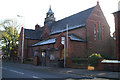
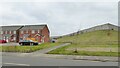
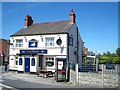
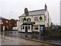
Area Overview for Hindley Green Ward
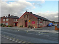
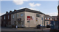
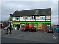
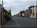
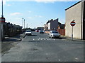
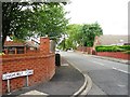
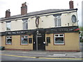
Photos of Hindley Green Ward

Area Information
Hindley Green Ward stands as an electoral ward and village within the Metropolitan Borough of Wigan, Greater Manchester. It occupies a specific land mass of 3.9 km², positioning it firmly in North West England. The area falls under the jurisdiction of the Wigan Metropolitan Borough Council and sits inside the Makerfield parliamentary constituency. Its geographical location is precise, marking coordinates at the British National Grid Reference SD 637.75 34.12. This translates to a latitude of 53.5261 and a longitude of -2.5479 for prospective buyers checking maps. The address format for this location typically follows the WN2 postcode district, such as WN2 3FW. Residents will find the village established within the existing administrative framework, offering a defined sense of place. The ward boundaries are clear, established by the council for voting and governance purposes. Living in Hindley Green Ward means residing in a jurisdiction with set coordinates and defined council oversight. You are located in an area where local government operates through the Wigan Metropolitan Borough structure. The physical footprint is compact at under four square kilometres, creating a tightly knit geographical unit. Your home here is part of a specific grid reference system used for surveying and mapping. This detail matters for anyone plotting commutes or assessing local infrastructure reach. The area is not a hypothetical zone; it is a verified ward with a fixed footprint in the North West region.
- Area Type
- District Borough Unitary Ward
- Area Size
- 3.9 km²
- Population
- Not available
- Population Density
- Not available
Demographics
The community profile of Hindley Green Ward reveals a very mature population. The median age across the ward reaches 70 years, indicating a resident base significantly older than the national average. Most households comprise individuals or older couples rather than young families. Home ownership stands at a high rate of 78 per cent of residents. This statistic suggests a borough dominated by settled families and retirees who have secured tenure. The remaining 22 per cent of the population likely rents or occupies different tenures. Household composition data reflects these age patterns, with fewer working-age families compared to urban centres. Accommodation types align with this demographic, favouring detached or semi‑detached homes suitable for empty nesters. You will find a neighbourhood where long-term residents form the backbone of daily life. The high ownership rate implies stability and less frequent student turnover or transient populations. For those considering homes in Hindley Green Ward, the demographic suggests a quiet setting shaped by older generation needs. Shared ownership or retirement-specific housing may feature prominently, though specific numbers for these categories are not detailed in the available statistics. The population skews heavily towards later life stages. Daily interactions in the village will reflect this maturity. Local services and amenities catering to this age group form the core of community life.
Household Size
Accommodation Type
Tenure
Ethnic Group
Religion
Household Composition
Age
Household Deprivation
NS-SEC
Explore more demographic insights in this area
Go to Demographics tabPlanning
Planning Constraints
- Flood RiskPremium
- Ramsar Wetland SitesPremium
- Area of Outstanding Natural BeautyPremium
- Protected Nature ReservePremium
- Protected WoodlandPremium
- Crime RiskPremium