Area Overview for Hincaster
Photos of Hincaster


Area Information
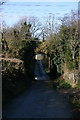
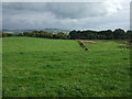
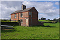
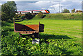
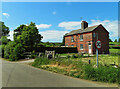
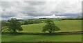
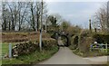
Hincaster is a small civil parish located in England, covering a total area of 2.8 square kilometres. Living in Hincaster means embracing a compact rural environment where daily life revolves around a close-knit local community. The sheer size of the area influences the pace of life; residents enjoy open spaces without the congestion of larger towns. You will find that this parish offers a quiet setting suitable for those seeking peace rather than the fast rhythm of city living. The landscape provides ample room for gardens and outdoor activities, making it an ideal choice for nature lovers who value their privacy. Homebuyers considering Hincaster should note the limited scale of the settlement, which fosters a distinct sense of neighbourliness. The area functions as a self-contained unit where local services and amenities are within easy reach. This compact footprint contributes to lower noise levels and a greener atmosphere compared to larger urban centres. The parish structure ensures that local governance remains focused on these specific boundaries, allowing for targeted improvements to the local environment. The character of Hincaster is defined by its rural heritage and established vibe. You do not find the sprawling developments typical of larger municipalities here; instead, the housing is integrated into the existing landscape. This makes Hincaster a practical choice for retirees or individuals who prefer a slower lifestyle. The limited size also means that travel times between homes and local facilities remain short. Every street and path adds to the charm, creating a homely atmosphere that attracts those valuing stability and natural beauty. Living in Hincaster offers a straightforward lifestyle without unnecessary complexity. The parish acts as a quiet retreat where residents can enjoy the benefits of country living while maintaining access to nearby infrastructure. The small scale ensures that you know your neighbours and that the community remains cohesive. Whether you walk to a local shop or venture further afield, the geography of Hincaster supports a calm and predictable daily routine. This parish presents a clear option for anyone prioritising a tranquil home environment over urban excitement.
- Area Type
- Parish
- Area Size
- 2.8 km²
- Population
- Not available
- Population Density
- Not available
Demographics
The community profile in Hincaster reflects a settled population with a median age of 70. This statistic indicates that a significant portion of the residents are senior citizens or retirees. Such an age distribution suggests the area caters primarily to those looking for their later years rather than young families or professionals seeking career advancement. The most common age range is broad, encompassing a wide demographic spread, yet the median figure remains the dominant indicator of the area's character. Living in Hincaster means joining a community where life expectancy and retirement plans play a central role in daily interactions. Home ownership stands at an impressive 86% within the parish. This figure highlights that the vast majority of households in Hincaster own their homes outright or with a mortgage. Such high levels of tenure stability foster deep roots within the community. You are unlikely to encounter transient populations here; instead, you will find long-term residents who have built lives in these grounds. This ownership rate contrasts sharply with transient rental markets found in major cities, creating a more consistent neighbourhood fabric. Household composition and accommodation types further reinforce this stable picture. The data describes the total household composition without specifying unique breakdowns, suggesting a uniformity in living arrangements typical of rural parishes. Predominant ethnic groups and religious affiliations are not broken down in the available records, indicating a homogenous society regarding cultural background. This lack of demographic diversity, combined with the high median age, paints a clear picture of a traditional demographic seeking quietude. Residents here value familiarity and established routines over cultural dynamism. Social deprivation and specific household types are not explicitly detailed in the provided records, but the high ownership rate implies financial stability among the local population. The demographic facts point to a region where people have stayed for decades, raising and retiring within the same locality. This continuity creates a safe and predictable environment where community bonds are strong. The age profile means that local services may be tailored to older needs, from healthcare access to leisure activities suitable for seniors. You will find a population that values the established rhythm of small-town living.
Household Size
Accommodation Type
Tenure
Ethnic Group
Religion
Household Composition
Age
Household Deprivation
NS-SEC
Explore more demographic insights in this area
Go to Demographics tabPlanning
Planning Constraints
- Flood RiskPremium
- Ramsar Wetland SitesPremium
- Area of Outstanding Natural BeautyPremium
- Protected Nature ReservePremium
- Protected WoodlandPremium
- Crime RiskPremium