Area Overview for Hill Dale
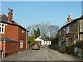
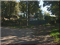
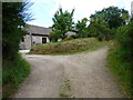
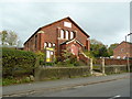
Photos of Hill Dale
Area Information
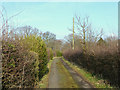
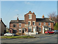
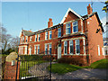
Hill Dale is a compact built-up area in England, spanning 32.1 hectares. It is a mature community, with a median age of 70, suggesting a population skewed towards older residents. Despite its size, the area offers practical connectivity, with five nearby rail stations including Parbold, Hoscar, and Appley Bridge, ensuring easy access to surrounding towns. Daily life here is shaped by proximity to essential retail outlets such as Morrisons Daily and Co-op Parbold, which cater to local needs. The high home ownership rate of 91% indicates a stable, long-term resident base. While the area lacks detailed demographic breakdowns on household composition or diversity, its safety and infrastructure suggest a functional, low-maintenance lifestyle. For those seeking a quiet, established neighbourhood with reliable transport links, Hill Dale provides a straightforward, community-focused environment.
- Area Type
- Built Up Area 250
- Area Size
- 32.1 hectares
- Population
- Not available
- Population Density
- Not available
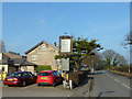
Hill Dale’s residents have access to a modest selection of retail and dining options within practical reach. The area includes five retail outlets such as Morrisons Daily, Co-op Parbold, and Spar, providing essential shopping needs. While no specific dining or leisure venues are listed, the presence of multiple retail stores suggests a functional, community-focused lifestyle. The rail stations nearby, including Parbold and Appley Bridge, offer convenient travel for work, shopping, or leisure activities beyond the immediate area. The lack of detailed information on parks or recreational spaces means the area’s leisure options are not specified, but the existing amenities imply a practical, no-frills approach to daily living.
Amenities
Schools
The nearest school to Hill Dale is Richard Durning’s Endowed Primary School, which has an Ofsted rating of "good." This primary school is the only educational institution explicitly listed in the data, meaning no secondary schools or other educational facilities are detailed. Families relying on local schools must consider the absence of higher education options in the immediate vicinity. The single primary school suggests a limited range of choices for parents, though its "good" rating indicates a satisfactory standard of education. For those prioritising proximity to schools, Hill Dale’s offerings are minimal, requiring additional travel for secondary education or alternative schooling arrangements.
| Rank | School | Type | Entry gender | Ages |
|---|
Explore more schools in this area
Go to Schools tabDemographics
The population of Hill Dale has a median age of 70, reflecting a community dominated by older residents. The most common age range is listed as "Total," which may indicate aggregated data rather than specific breakdowns. Home ownership is exceptionally high at 91%, suggesting a predominantly owner-occupied area with limited rental stock. Accommodation types and household composition are not specified in the data, so no conclusions can be drawn about family structures or property diversity. The predominant ethnic group and religious affiliation are also not detailed, meaning the area’s cultural or social composition remains unclear. While the data does not include deprivation metrics, the high home ownership and low crime risk imply a relatively stable quality of life for residents.