Area Overview for Higher Irlam & Peel Green Ward
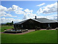
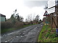
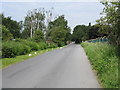
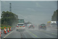
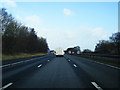
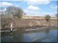
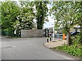
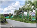
Photos of Higher Irlam & Peel Green Ward
Area Information
Higher Irlam & Peel Green Ward stands as a distinct electoral ward within the Salford metropolitan borough, covering a land area of 10.4 square kilometres. This specific designation was formalised for the 2021 local elections by the Local Government Boundary Commission for England, which replaced the former Irlam ward that had served the community since May 2004. The area is situated at coordinates approximately 53.47°N, 2.40°W, placing it deep within North West England. Political representation is held by Tracy Kelly, Roger Jones, and Peter Taylor, all of whom were elected as Labour councillors for their four-year terms. At the Westminster level, the ward falls under the constituency of Worsley and Eccles South, represented by Barbara Keeley MP. Currently, the population totals 1,365 residents spread across this 10.4 km² footprint, resulting in a population density of 131 people per square kilometre. This relatively low density suggests a residential character where open spaces are common and housing plots are likely spacious. The creation of this new ward split the old Irlam ward into two distinct entities, Higher Irlam & Peel Green and Cadishead and Lower Irlam, reflecting ongoing boundary reorganisation in Salford. Daily life here is shaped by this specific local governance structure and its position within the wider Manchester urban area.
- Area Type
- District Borough Unitary Ward
- Area Size
- 10.4 km²
- Population
- 1365
- Population Density
- 131 people/km²
Demographics
The demographic profile of Higher Irlam & Peel Green Ward reveals a significant shift towards an older population, with a median age of 70 years. This indicates the community is composed largely of seniors who may be approaching or have already reached retirement. Despite this, the data categorises the most common age range as "Total", providing the aggregate view of this established population. Home ownership is a dominant feature of the local statistics, with 58% of households reporting that they own their homes. This level of tenure suggests a community where many residents have long-term stability and investment in their local properties. The ward contains 1,365 individuals living across the 10.4 km² area, which averages out to 131 people per square kilometre of land. Accommodation types, ethnic composition, religion, and detailed household breakdowns are recorded in the official data but are not itemised separately in the current summary aggregate. These figures describe a quiet, mature community where the majority of the population structures their lives around ownership and established roots. The relatively low density and high ownership rate typically correlate with a neighbourhood supporting those who value stability over rapid change.
Household Size
Accommodation Type
Tenure
Ethnic Group
Religion
Household Composition
Age
Household Deprivation
NS-SEC
Explore more demographic insights in this area
Go to Demographics tabPlanning
Planning Constraints
- Flood RiskPremium
- Ramsar Wetland SitesPremium
- Area of Outstanding Natural BeautyPremium
- Protected Nature ReservePremium
- Protected WoodlandPremium
- Crime RiskPremium