Area Overview for Higher Hurdsfield
Photos of Higher Hurdsfield
Area Information
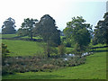
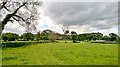
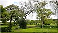
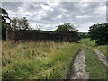
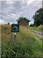
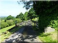
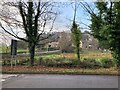
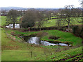
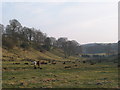
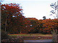
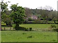
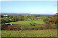
Higher Hurdsfield stands as a quiet civil parish on the eastern outskirts of Macclesfield, covering a compact landscape of just 2.2 km². You will find this locality surrounded by open countryside, sitting approximately 7 miles from the Cheshire-Derbyshire border. The community has deep historical roots, featuring Grade II listed structures such as Shrigley Fold Farm, which dates back to around 1700. Early developments included a Sunday School built in 1811 and Ebenezer Methodist Chapel, which once served as a social hub for the labouring families. Today, the area retains its rural character despite its proximity to Macclesfield. You navigate this peaceful setting with neighbours who live within a close-knit circle of about 300 residents, though census figures from 2011 record a slightly higher total of 717. A former pumping engine house and various canal bridges remain visible reminders of the Macclesfield Canal's historical importance to the region. Living in Higher Hurdsfield offers a blend of historic charm and rural seclusion. The village operates under its own parish council, managing local issues independently from the broader unitary authority of Cheshire East. This administrative setup ensures you can engage directly with the specific people who govern your immediate neighbourhood. The area feels distinctly separated from the main town while remaining conveniently located for those who need to access Macclesfield amenities nearby.
- Area Type
- Parish
- Area Size
- 2.2 km²
- Population
- Not available
- Population Density
- Not available
Demographics
The community profile of Higher Hurdsfield reveals a settlement dominated by older residents. The median age in the parish reaches 70 years, indicating a population where senior citizens form the core demographic. While specific breakdowns for other age groups are not detailed, the data confirms that age remains the primary defining characteristic of the resident body. Household composition data is listed as a general category, meaning specific family structures like family homes versus single-person households are not numerically differentiated in the current records. You should expect a neighbourhood where long-term stability is common, as 85 per cent of residents own their homes outright. This high ownership rate signals a community where people put down deep roots and stay for the long term. The lower street走一走 suggests a demographic dynamic where young families or young professionals may be less represented compared to retirees. Ethnic diversity and religious affiliation figures are recorded as general totals, so detailed breakdowns of specific minority groups are not available in the current dataset. However, the overall picture points to a secure, established neighbourhood. The dominance of owner-occupied property means you are entering a market where most neighbours have invested their life savings into local properties. This concentration of home ownership often correlates with lower turnover rates and a quiet, predictable environment.
Household Size
Accommodation Type
Tenure
Ethnic Group
Religion
Household Composition
Age
Household Deprivation
NS-SEC
Explore more demographic insights in this area
Go to Demographics tabPlanning
Planning Constraints
- Flood RiskPremium
- Ramsar Wetland SitesPremium
- Area of Outstanding Natural BeautyPremium
- Protected Nature ReservePremium
- Protected WoodlandPremium
- Crime RiskPremium