Area Overview for Higher Folds
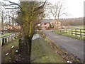
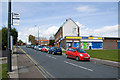
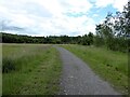
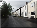
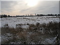
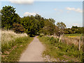
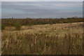
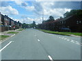
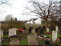
Photos of Higher Folds


Area Information
Higher Folds is a compact built-up area in England, covering 43.4 hectares. Its population, while not explicitly stated, is reflected in its amenities and infrastructure, which cater to a community with a median age of 70. This suggests a mature demographic, likely with established families or retirees. The area is well-served by nearby schools, rail links, and retail options, making it practical for daily life. Proximity to Atherton Railway Station and Daisy Hill Railway Station offers easy access to surrounding towns, while the nearby City Airport Manchester and Trafford Centre metro provide additional connectivity. Higher Folds blends practicality with accessibility, though its small size means amenities are concentrated. For those prioritising convenience and a settled community, the area offers a mix of services within walking or short driving distance. The presence of two primary schools, including a Catholic school with a good Ofsted rating, adds to its appeal for families. However, the area’s character is defined by its older population and the need for careful consideration of safety and security, as highlighted by local assessments.
- Area Type
- Built Up Area 250
- Area Size
- 43.4 hectares
- Population
- Not available
- Population Density
- Not available
Higher Folds offers a range of amenities within practical reach, including five retail outlets such as Morrisons Daily Higherfold, Iceland Tydlesley, and Heron Shakerley. These shops provide everyday essentials, supporting a convenient lifestyle. The area’s rail network, with stations like Atherton and Daisy Hill, connects residents to broader regional services, while the nearby Trafford Centre metro and City Airport Manchester enhance accessibility. Though no parks or leisure facilities are listed in the data, the proximity to rail and retail suggests a focus on practicality over leisure. The compact nature of the area means amenities are concentrated, reducing travel time for errands. For those valuing convenience and proximity to transport, Higher Folds delivers, though buyers should assess whether the lack of detailed leisure options aligns with their lifestyle preferences.
Amenities
Schools
Higher Folds is served by two primary schools: Higher Folds Primary School and St Gabriel’s Catholic Primary School, which holds a good Ofsted rating. Both institutions cater to the area’s younger residents, offering a mix of state and faith-based education. St Gabriel’s Catholic Primary’s good rating suggests it meets or exceeds national standards in teaching and pupil outcomes. The presence of two primary schools provides families with options, whether they prioritise a state school or a Catholic education. However, no secondary schools are mentioned in the data, so parents may need to consider commuting to nearby towns for secondary education. For families with young children, the proximity of these schools is a practical advantage, though the absence of secondary schooling within the area may require planning for longer-term educational needs.
| Rank | A + A* % | School | Type | Entry gender | Ages |
|---|---|---|---|---|---|
| 1 | N/A | Higher Folds Primary School | primary | N/A | N/A |
| 2 | N/A | St Gabriel's Catholic Primary School | primary | N/A | N/A |
Explore more schools in this area
Go to Schools tabDemographics
The population of Higher Folds has a median age of 70, indicating a predominantly older demographic. The most common age range is listed as "Age: Total," which may reflect aggregated data rather than specific age brackets. Home ownership stands at 49%, suggesting that nearly half of properties are owner-occupied, while the remaining 51% are likely rented. Household composition and accommodation types are noted as "total," meaning no breakdown of family structures or property types is available. The predominant ethnic group and religious affiliation are also listed as "total," offering no granular insight into diversity. This lack of detail means the community’s social fabric remains opaque. However, the 49% home ownership rate implies a mix of long-term residents and renters, potentially influencing local dynamics. For buyers, understanding the area’s older demographic and limited data on diversity may be important when assessing community needs and lifestyle compatibility.
Household Size
Accommodation Type
Tenure
Ethnic Group
Religion
Household Composition
Age
Household Deprivation
NS-SEC
Explore more demographic insights in this area
Go to Demographics tabPlanning
Planning Constraints
- Crime RiskLocked