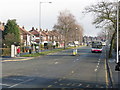
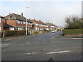
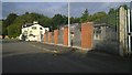
Area Overview for Higher Blackley Ward

River Irk, Higher Blackley in Higher Blackley Ward
Blackley - Victoria Avenue at Glenbrook Road in Higher Blackley Ward
Blackley - Glenbrook Road in Higher Blackley Ward
Old Hall Lane, Manchester in Higher Blackley Ward
Sainsbury's, Prestwich in Higher Blackley Ward
M60 clockwise at Junction 19 on-slip in Higher Blackley Ward
Post Office and shop on Victoria Avenue, Manchester in Higher Blackley Ward
Service station on Victoria Avenue (A6104), Manchester in Higher Blackley Ward
Bus stop on Victoria Avenue (A6104), Manchester in Higher Blackley Ward
Shop and Dental Practice on Victoria Avenue, Manchester in Higher Blackley Ward
M60 Motorway, Junction 19 in Higher Blackley Ward
Elizabeth II postbox and telephone box on Victoria Avenue, Manchester in Higher Blackley Ward
51 photos from this area

Area Information

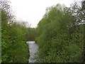
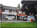
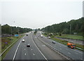
Higher Blackley Ward sits within the City of Manchester in Greater Manchester, covering an area of 7.3 square kilometres. This electoral ward is part of the historic Blackley township, identified as the northernmost settlement within the medieval parish of Manchester. The community traces its roots to the 14th century when large deer parks existed in well-wooded areas by 1355. By the early 17th century, Humphrey Booth owned a considerable estate there and built Booth Hall around 1639–40. Today, the ward forms a distinct residential zone with a population of approximately 5,073 residents. You are entering an area defined by its historical significance and current density, where history situates the location alongside the Manchester and Middleton turnpike road. The ward coordinates place it firmly within the Barony of Manchester, offering a specific locality within the wider city structure. Living in Higher Blackley Ward means residing in a space where medieval land management once dictated the landscape, while modern estate management now governs the 7.3 square kilometres. The area represents a slice of Manchester's long history, specifically the Blackley Estate which transferred ownership in 1433 to Sir John Byron.

Area Type
District Borough Unitary Ward
Area Size
7.3 km²
Population
5073
Population Density
691 people/km²

Demographics

The population of Higher Blackley Ward stands at 5,073 people, living across 7.3 square kilometres. Demographic data reveals a median age of 70 years, indicating a very elderly community residing in this district. The most common age grouping reflects this older profile, suggesting that many residents live in the area for extended periods. Home ownership is present in 45% of the ward, meaning nearly half of the households own their property outright or with a mortgage. The remaining 55% of residents rent their accommodation, creating a mixed but predominantly owner-occupied market. The ward displays a specific household composition distribution that aligns with the high median age, as younger families represent a smaller fraction of the total population. Ethnic and religious diversity data is recorded within the ward's official statistics, reflecting a multicultural makeup typical of Greater Manchester. You should note that the high median age suggests a quiet environment where daily life is paced for those seeking retirement or later-life residency. With elderly residents dominating the age profile, local services often cater to specific health and mobility needs common in this demographic bracket.

Household Size

total
most common

Accommodation Type

total
most common

Tenure

45
majority

Ethnic Group

total
most common

Religion

total
most common

Household Composition

total
most common

Age

70
median
Age: Total
most common

Household Deprivation

N/A
with no deprivation

NS-SEC

21
in Lower managerial occupations

Explore more demographic insights in this area

Go to Demographics tab

Planning

Planning Constraints

  • Flood Risk
    Premium
  • Ramsar Wetland Sites
    Premium
  • Area of Outstanding Natural Beauty
    Premium
  • Protected Nature Reserve
    Premium
  • Protected Woodland
    Premium
  • Crime Risk
    Premium

Explore more planning insights in this area

Open Planning map

Frequently Asked Questions

What makes the community feel like in Higher Blackley Ward?
Higher Blackley Ward hosts a population of 5,073 with a median age of 70, creating a quiet, elderly-focused community. With 45% home ownership, many long-term residents stay in their properties for extended periods. The ward is part of the historic Blackley township within Manchester, known for its 14th-century roots and proximity to Booth Hall. Daily life likely involves slower-paced neighbourhood interactions compared to younger urban districts. This mix of history and older residents defines the local social fabric and community dynamics.
Who typically lives in Higher Blackley Ward?
The residents of Higher Blackley Ward are predominantly older adults. With a median age of 70 years, the community reflects a significant retirement or mature demographic. Only 45% of the population owns their home, while the rest rent. The ward is located in the City of Manchester, Greater Manchester, and forms part of the Barony of Manchester. This age profile suggests a lifestyle centred around retirement, with fewer young families present than in other urban wards.
How reliable is internet access for working from home?
Digital infrastructure in Higher Blackley Ward is highly reliable. The fixed broadband quality score reaches 95 out of 100, indicating excellent connection speeds suitable for video calls and large data transfers. residents can expect uninterrupted access to online services throughout the 7.3 square kilometres of the ward. This connectivity level ensures that working from home is feasible without technical frustration. Mobile coverage also supports high-quality data transmission across the entire area, matching the robust fixed-line standards.
Is Higher Blackley Ward safe regarding crime and flooding?
Safety varies significantly within the ward. The crime risk assessment is critical with a score indicating above-average crime rates, suggesting enhanced security measures are necessary. However, flood risk is very low with a score of 2.44 out of 100, meaning properties face minimal threat from water flooding. There are no protected nature reserves or woodlands to complicate building plans. You must weigh the environmental safety against the elevated crime statistics when assessing risk. Enhanced security arrangements are often required due to the critical crime level rating.

We use cookies to provide you with the best experience. By continuing, you agree to our Cookie Policy .