Area Overview for High Legh
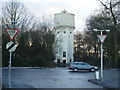
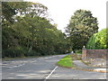
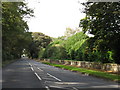
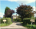
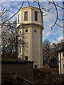
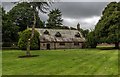
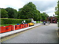
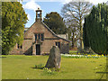
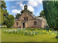
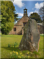
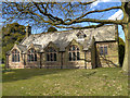
Photos of High Legh

Area Information
High Legh is a compact built-up area spanning 47.5 hectares in England, characterised by its mature demographic profile and established infrastructure. With a median age of 70, the community reflects a settled population, many of whom are likely long-term residents. This area is not defined by rapid expansion but by a quiet, stable presence within the surrounding landscape. Living here means proximity to essential services, including retail hubs like M&S Lymm and Sainsburys, as well as rail connections to Knutsford and Hale. The area’s small size ensures a tight-knit environment, where daily life is shaped by local amenities and familiar routes. For those seeking a low-maintenance, well-connected lifestyle, High Legh offers a balance of convenience and tranquillity. Its proximity to transport links and schools, such as High Legh Primary School, makes it appealing for families and individuals alike. While not a bustling urban centre, its practicality and safety score of 88/100 suggest a community that prioritises stability over spectacle.
- Area Type
- Built Up Area 250
- Area Size
- 47.5 hectares
- Population
- Not available
- Population Density
- Not available
High Legh’s lifestyle is shaped by its proximity to practical amenities. Retail options include M&S Lymm and Sainsburys Lymm, offering shopping convenience within easy reach. The area’s rail connections to Knutsford, Hale, and Ashley provide access to broader regional services, while the Timperley metro station enhances transport flexibility. Though the data does not specify parks or leisure facilities, the presence of multiple retail and transport hubs suggests a community focused on accessibility. The compact size of High Legh means residents can reach essentials quickly, balancing convenience with a quieter, less sprawling environment.
Amenities
Schools
High Legh Primary School is the only school explicitly listed near the area, offering primary education with a good Ofsted rating. This ensures a solid foundation for younger children, though the data does not mention secondary schools or other educational institutions. Families relying solely on High Legh’s schools may need to consider commuting to nearby towns for secondary education. The presence of a well-rated primary school is a key draw for families, but the absence of detailed data on other schools means prospective buyers should verify additional educational options in the surrounding region.
| Rank | School | Type | Entry gender | Ages |
|---|
Explore more schools in this area
Go to Schools tabDemographics
High Legh’s population is predominantly older, with a median age of 70, which is notably higher than the national average. This suggests a community where retirement is the primary stage of life, with many residents likely to have lived in the area for decades. Home ownership is high at 79%, indicating a strong preference for long-term residency over rental properties. The data does not specify household composition or accommodation types, but the high ownership rate implies a mix of family homes and larger properties. The absence of detailed diversity metrics means the area’s ethnic and religious composition remains unquantified, though the “total” category for these fields suggests no singular dominant group. For quality of life, the high median age may mean a focus on accessible healthcare and community services, though specific data on deprivation is not provided.
Household Size
Accommodation Type
Tenure
Ethnic Group
Religion
Household Composition
Age
Household Deprivation
NS-SEC
Explore more demographic insights in this area
Go to Demographics tabPlanning
Planning Constraints
- Crime RiskPremium