Area Overview for Heywood
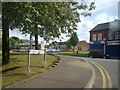
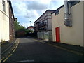
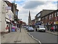
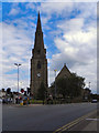
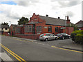
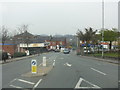
Photos of Heywood


Area Information
Heywood is a compact built-up area in England, spanning 7.5 km² and home to 7,451 residents. Its population density of 987 people per square kilometre reflects a tight-knit community, though the median age of 70 suggests a predominantly older demographic. This is a small town with a distinct character, where daily life is shaped by local amenities and proximity to transport links. The area offers practical access to retail, schools, and public transport, including supermarkets like Iceland, Tesco, and Morrisons. Residents benefit from nearby railway stations such as Castleton and Rochdale, as well as bus services connecting to Bury Interchange. While the population is older, the mix of primary schools and community hubs ensures a functional infrastructure for families. Heywood’s charm lies in its simplicity, but its challenges—such as high crime risk—require careful consideration for potential buyers.
- Area Type
- Built Up Area 250
- Area Size
- 7.5 km²
- Population
- 7451
- Population Density
- 987 people/km²
Heywood’s lifestyle is shaped by its practical amenities, including retail hubs like Iceland, Tesco, and Morrisons, which provide everyday shopping convenience. The area’s transport links—railway stations and bus routes—offer access to nearby towns such as Bury and Rochdale. While the data does not specify parks or leisure facilities, the presence of multiple schools and community spaces suggests a focus on local living. The mix of primary schools and accessible transport makes it suitable for families, though buyers should consider the lack of detailed information on recreational amenities. Overall, Heywood offers a functional lifestyle with a balance of essentials, though its charm lies in its simplicity rather than expansive leisure options.
Amenities
Schools
Heywood is served by a range of primary schools, including Derby Street Nursery Unit, Bullough Moor Primary School, Darnhill Community School, Moss Field Community School, and Harwood Park Primary School, which holds an Ofsted rating of ‘good’. These institutions provide options for families, though no secondary schools are listed in the data. The presence of multiple primary schools within the area ensures accessibility for young children, with Harwood Park’s positive rating offering reassurance for parents seeking quality education. However, the absence of secondary school data means families may need to look beyond Heywood for comprehensive schooling. The mix of community-focused schools suggests a focus on local education, but buyers should verify the full range of educational opportunities available.
| Rank | A + A* % | School | Type | Entry gender | Ages |
|---|---|---|---|---|---|
| 1 | N/A | Derby Street Nursery Unit | nursery | N/A | N/A |
| 2 | N/A | Bullough Moor Primary School | primary | N/A | N/A |
| 3 | N/A | Darnhill Community School | primary | N/A | N/A |
| 4 | N/A | Moss Field Community School | primary | N/A | N/A |
| 5 | N/A | Harwood Park Primary School | primary | N/A | N/A |
Explore more schools in this area
Go to Schools tabDemographics
Heywood’s population is defined by its median age of 70, indicating a community skewed toward older residents. The most common age range is not specified, but the data suggests a demographic profile that may influence local services and amenities. Home ownership is at 57%, meaning nearly half of residents live in their own homes, while the remaining 43% are likely renters. The accommodation types and household composition are not detailed, but the high population density implies a mix of housing stock. The area’s demographics suggest a community with specific needs, such as accessible healthcare and social services. While no data on ethnic diversity or religion is provided, the absence of such details does not reflect a lack of diversity—only that it is not quantified in the dataset.
Household Size
Accommodation Type
Tenure
Ethnic Group
Religion
Household Composition
Age
Household Deprivation
NS-SEC
Explore more demographic insights in this area
Go to Demographics tabPlanning
Planning Constraints
- Crime RiskLocked