Area Overview for Hethersgill
Photos of Hethersgill

Area Information
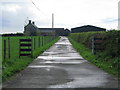
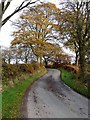
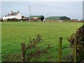
Living in Hethersgill means settling into a rural civil parish within the Cumberland unitary authority and ceremonial county of Cumbria, North West England. The parish covers 22.1 km² and encompasses the main village alongside smaller settlements such as Boltonfellend, Ullermire, Howford Bridge, Nether Onset, and Uppertown. Dispersed farms complete the landscape across this defined area. Visitors and prospective residents will find a setting embedded in history, comprising structures that date back to the mid-17th century. Kirklinton Hall is reputedly built from 1660 by Edmund Appleby, though earlier structures may have existed on the site. The community includes 17 listed buildings recorded in the National Heritage List for England, underscoring the historical character of the built environment. You are looking at a location that functions as a distinct parish with a formalised administrative history. Originally a township in the Kirklinton ancient parish and Eskdale ward, Hethersgill became a civil parish under the Poor Law Amendment Act 1866. It previously belonged to the Longtown Poor Law Union. The local ecclesiastical infrastructure features the Church of St Mary, constructed in 1876 as a chapel of ease. A Wesleyan Methodist chapel was established at Ullermire in 1833 before later moving to the Hethersgill village itself. Daily life here revolves around these historic anchors and the quiet dispersion of residents across farms and hamlets. The 2021 Census records a population of 350, indicating a very small, tight-knit community spread over a significant rural footprint.
- Area Type
- Parish
- Area Size
- 22.1 km²
- Population
- Not available
- Population Density
- Not available
Demographics
The community profile in Hethersgill is defined by a significant chain of ownership and a settled population. Data indicates that 82% of households are owner-occupied, which is a distinctly high figure within the current national housing landscape. This high level of tenure stability suggests that the village has attracted long-term residents who have invested in their local homes. The median age for residents is recorded at 70 years, pointing towards a population heavily weighted towards older demographics. You should note that the overwhelming majority of dwellings fall into the owner-occupied category, meaning competition for rentals is unlikely to be an issue. While the data indicates a median age of 70, detailed breakdowns regarding the most common age ranges are not specified in the available census records. Consequently, specific claims about the distribution of children or young adults cannot be substantiated with the current figures. The parish generally reflects a rural retirement or established settler profile rather than a young professional cohort. Specific data on predominant ethnic groups, religion, and detailed household composition nuances are not captured in the provided summary metrics, which typically aggregate these demographics under a single total figure for small parishes. You are entering a demographic environment characterised by permanence and age. The housing stock mirrors this reality, with very few second homes or short-term lets disrupting the local rhythm. The 350-strong population is concentrated enough to maintain community links but sparse enough to require significant travel for major services.
Household Size
Accommodation Type
Tenure
Ethnic Group
Religion
Household Composition
Age
Household Deprivation
NS-SEC
Explore more demographic insights in this area
Go to Demographics tabPlanning
Planning Constraints
- Flood RiskPremium
- Ramsar Wetland SitesPremium
- Area of Outstanding Natural BeautyPremium
- Protected Nature ReservePremium
- Protected WoodlandPremium
- Crime RiskPremium