Area Overview for Heskin
Photos of Heskin

Area Information
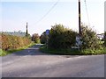
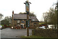
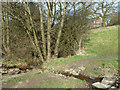
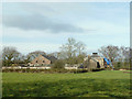
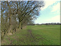
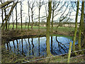
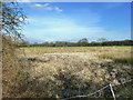
Heskin is a small civil parish located in England, covering a total area of 5.0 km². This compact size defines the character of daily life here, offering a close-knit environment rather than the sprawl of larger urban centres. Living in Heskin means navigating a neighbourhood that has managed to retain its distinct identity without expanding significantly. The physical boundaries of the parish keep the community contained, which often results in quieter streets and a slower pace compared to surrounding towns. You will find that the area is defined by its scale; it is a place where local interactions are frequent because the geography encourages familiarity between neighbours. There are no major industrial zones or large commercial developments within the 5.0 km² limit, which keeps the visual and auditory landscape relatively peaceful. The size also means that amenities are likely concentrated in specific pockets, requiring short walks or drives to reach shops or services. This layout reinforces a sense of locality where residents know their immediate surroundings intimately. When considering homes in Heskin, you are entering a space defined by its boundaries and the people who call it home. The area does not pose significant physical planning constraints, making it a stable environment for those who value a settled, predictable setting. It is a place where the land itself is as much a part of the community as the houses built upon it.
- Area Type
- Parish
- Area Size
- 5.0 km²
- Population
- Not available
- Population Density
- Not available
Demographics
The community in Heskin presents a clear demographic profile centred around older residents. The median age stands at 70, indicating that the population is significantly skewed towards seniors. Most people fall into the broader age category designated as Total, meaning the specific distribution across younger brackets is minimal. Home ownership is exceptionally high, with 87% of residents holding the title deeds to their property. This figure suggests a community where few people rent, and the vast majority have either purchased or inherited their homes over many years. The high ownership rate often correlates with stability and long-term local investment. Household composition and accommodation type data are recorded as total, reflecting the aggregate statistics of the parish without breaking down specific dwelling configurations like flats or bungalows separately. Ethnic and religious breakdowns are also noted as total, indicating that the census captures the whole population as a single statistical unit rather than highlighting specific minority groups that might exist in smaller numbers. There is a notable absence of deprivation data in the provided information, so any commentary on economic disadvantage cannot be made. The safety score of 86/100 provides a reliable metric for quality of life, showing that crime risk is well below average. Living in Heskin means joining a society dominated by older homeowners who enjoy a prosperous and secure environment.
Household Size
Accommodation Type
Tenure
Ethnic Group
Religion
Household Composition
Age
Household Deprivation
NS-SEC
Explore more demographic insights in this area
Go to Demographics tabPlanning
Planning Constraints
- Flood RiskPremium
- Ramsar Wetland SitesPremium
- Area of Outstanding Natural BeautyPremium
- Protected Nature ReservePremium
- Protected WoodlandPremium
- Crime RiskPremium