Area Overview for Helmshore Ward
Photos of Helmshore Ward
Area Information
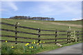
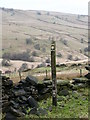
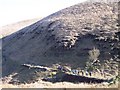
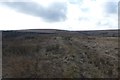
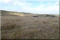
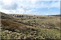
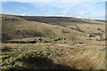
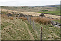
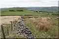
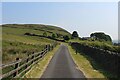
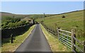
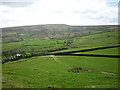
Living in Helmshore Ward offers a distinct pace of life within the Rossendale Valley of North West England. This district borough unitary ward covers an area of 19.0 km² and sits at coordinates 53.691348, -2.329226 near postcode BB4 4GD. The village developed along the River Ogden valley as a settlement for mill workers during the Industrial Revolution, gradually superseding the earlier name Musbury. You will find yourself in a place defined by historic textile heritage set against a rural backdrop, with development occurring primarily between the 1790s and now. The community remains small and established, with a current population of 1510 residents. This low population density of 79 people per km² creates a quiet environment where history is visible from the streets. The area was once powered by the damp climate that aided wool, cotton, and linen production in major mills like Higher Mill and Whitaker Mill. Today, remnants of this industrial past include the Helmshore Mills Textile Museum, which houses two historic working mills. You could be standing near the original waterwheel at Higher Mill or looking at the chimney from William Turner's 1820s steam-powered mill while enjoying the peace of the valley. Educational opportunities and modern amenities are woven into this historic fabric. The area retains links to its past through early 20th-century industry, such as the work performed at the Holden Wood Manufacturing Company during the Second World War. Whether you value the quiet of Grane or Alden valleys or the cultural depth of the museum, Helmshore Ward provides a specific type of living experience that blends rural tranquility with tangible local history.
- Area Type
- District Borough Unitary Ward
- Area Size
- 19.0 km²
- Population
- 1510
- Population Density
- 79 people/km²
Demographics
The community in Helmshore Ward presents a clear demographic profile suited to specific lifestyle needs. The median age stands at 70, making this the most critical statistical feature of your potential new home. Most residents are older than the national average, suggesting a settlement dominated by retirees rather than young families or professional transplants. This age profile aligns with the historical context of the town, which was built around housing the workforce for the cotton and woollen mills that thrived from the late 18th century onwards. You should expect a high level of stability regarding home ownership, with 80% of residents owning their property outright or with a mortgage. This statistic indicates a low level of rental turnover and a community invested in long-term residency. The data does not specify the breakdown of household composition or ethnicity in detail, but the high ownership rate implies residents who view Helmshore Ward as a permanent home. These factors combine to create a neighbourhood where social ties are likely deep-rooted and turnover is minimal. For a prospective buyer, the population density of 79 people per square kilometre reinforces the sense of a place where people stay for decades. With no data suggesting a younger influx, you are likely to engage with a mature community. The overarching picture a homebuyer can deduce is a stable, owner-occupied village where the resident population mirrors the historic settlement patterns of the Rossendale Valley. Any research into this area confirms that the social fabric is consistent with the age demographics and high ownership figures.
Household Size
Accommodation Type
Tenure
Ethnic Group
Religion
Household Composition
Age
Household Deprivation
NS-SEC
Explore more demographic insights in this area
Go to Demographics tabPlanning
Planning Constraints
- Flood RiskPremium
- Ramsar Wetland SitesPremium
- Area of Outstanding Natural BeautyPremium
- Protected Nature ReservePremium
- Protected WoodlandPremium
- Crime RiskPremium